
Kiểu dáng dựa trên dữ liệu cho ranh giới cho phép bạn truy cập vào đa giác của Google cho ranh giới hành chính, áp dụng kiểu dáng cho đa giác ranh giới, hiển thị các đa giác đó trên bản đồ.
Kiểu dáng dựa trên dữ liệu cho ranh giới cho phép bạn nhắm mục tiêu theo khu vực theo mã địa điểm và áp dụng kiểu tuỳ chỉnh cho đa giác ranh giới trên bản đồ. Mỗi loại đối tượng đại diện cho một loại khu vực; bạn chọn loại đối tượng cần bật khi định cấu hình kiểu bản đồ. Hãy tham khảo bài viết Phạm vi cung cấp thông tin về ranh giới của Google để xem phạm vi cung cấp thông tin về ranh giới theo quốc gia.
Loại đối tượng
Kiểu dựa trên dữ liệu cung cấp quyền truy cập vào các ranh giới của Google cho các loại đối tượng đại diện cho các khu vực hành chính. Khu vực hành chính được phân loại theo chức năng, ví dụ: quốc gia, tiểu bang, địa phương và mã bưu chính. Các loại đối tượng được sắp xếp theo cấp quản lý, cấu trúc của các loại đối tượng này sẽ khác nhau tuỳ theo quốc gia. Đó là:
GMSFeatureTypeCountry– Thực thể chính trị quốc gia, thường là loại thứ tự cao nhất.GMSFeatureTypeAdministrativeAreaLevel1– Một pháp nhân dân sự cấp 1 ở cấp thấp hơn quốc gia. Tại Hoa Kỳ, các cấp hành chính này là tiểu bang.GMSFeatureTypeAdministrativeAreaLevel2– Một pháp nhân dân sự cấp hai bên dưới cấp quốc gia. Tại Hoa Kỳ, các cấp hành chính này là hạt.GMSFeatureTypeLocality– Một pháp nhân chính trị là thành phố hoặc thị trấn được hợp nhất.GMSFeatureTypePostalCode– Mã bưu chính, dùng để gửi thư bưu chính trong quốc gia.GMSFeatureTypeSchoolDistrict– Học khu; bao gồm trường liên cấp, tiểu học và trung học.
Các khu vực hành chính được thể hiện trên bản đồ dưới dạng lớp đối tượng; mỗi loại có một lớp riêng. Lớp đối tượng được bật theo kiểu bản đồ. Bạn có thể chọn lớp đối tượng cần bật khi thiết lập kiểu bản đồ trong Google Cloud Console.
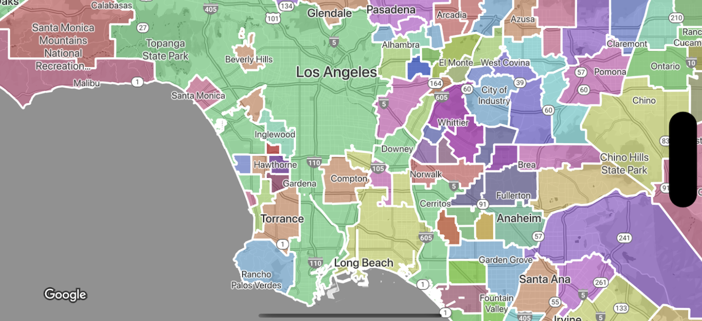
Đa giác ranh giới kiểu
Bạn có thể áp dụng kiểu cho đa giác ranh giới để đổ màu (màu, độ mờ) và nét (màu, độ mờ, độ đậm nét). Sử dụng kiểu để:
- Định kiểu cho đa giác ranh giới hoặc hiển thị tất cả ranh giới cho một loại đối tượng.
- Tạo bản đồ chuyên đề.
Thẻ Phạm vi cung cấp ranh giới của Google cho biết phạm vi cung cấp các loại đối tượng theo quốc gia.