Mencari fitur canggih untuk ditambahkan ke peta Anda? Library Utilitas Maps SDK for iOS di GitHub adalah library open source class yang berguna untuk berbagai aplikasi. Repositori GitHub menyertakan berbagai class utilitas dan aplikasi demo yang mengilustrasikan penggunaan setiap class.
Utilitas
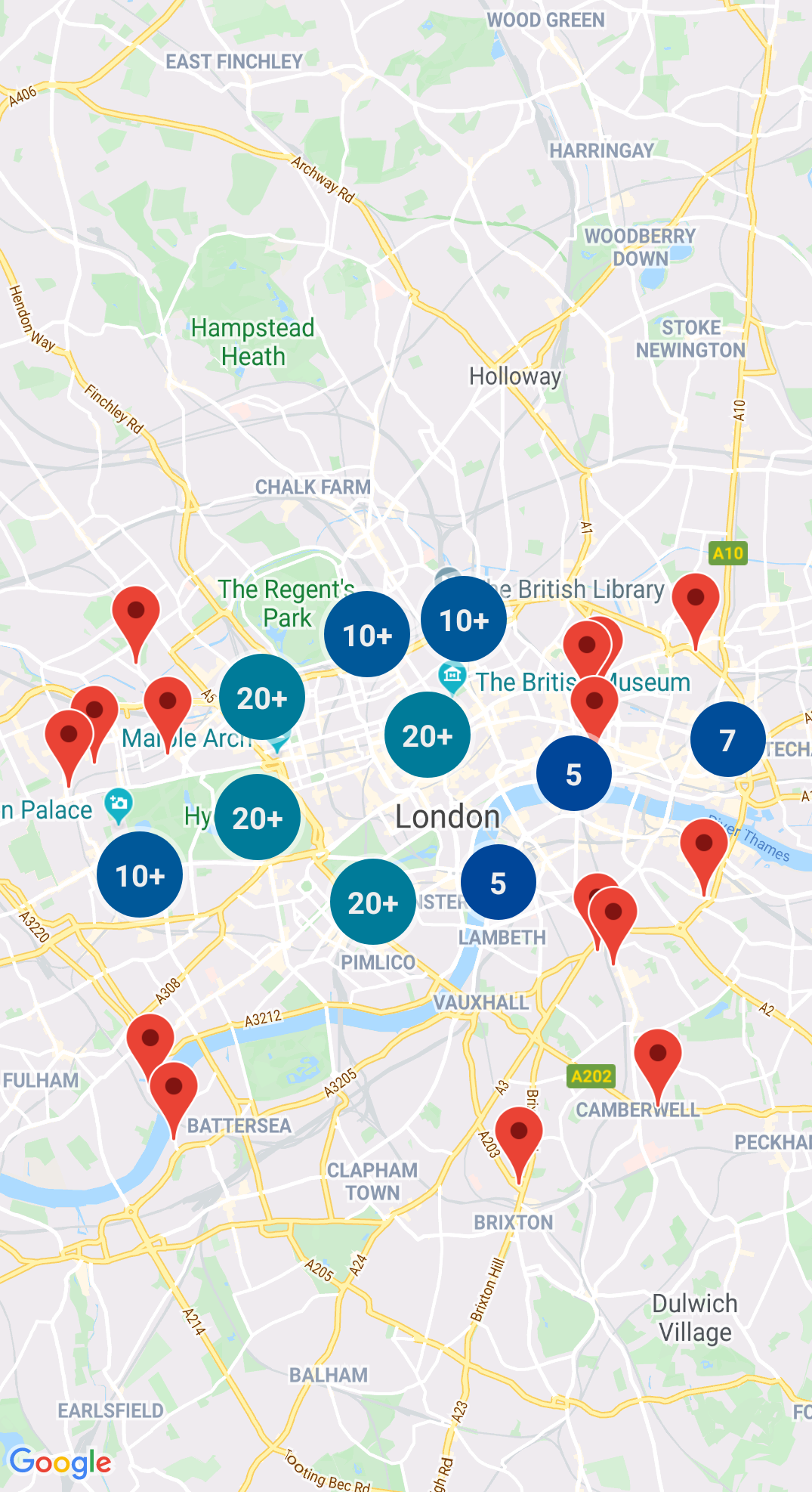
Pengelompokan Penanda
GMUClusterManager membantu Anda mengelola beberapa penanda pada tingkat zoom yang berbeda. Artinya, Anda dapat menempatkan banyak penanda di peta tanpa menyulitkan pembacaan peta. Jika pengguna menampilkan peta pada tingkat zoom yang tinggi, setiap penanda akan ditampilkan di peta. Jika pengguna memperkecil tampilan ke tingkat zoom yang lebih rendah, semua penanda akan menyatu menjadi cluster agar peta lebih mudah ditampilkan.
Quadtree adalah struktur data yang berguna untuk menemukan titik di dekat satu titik, dengan menelusuri di dalam area yang mengelilingi lokasi menarik.
Untuk mengetahui detailnya, lihat dokumentasi di Quadtree.
KML
KML adalah format populer untuk merender data geografis seperti titik, garis, dan poligon. GMUKMLParser
memungkinkan Anda mengurai dan merender data geografis dalam format KML.
Untuk mengetahui detailnya, lihat dokumentasi tentang
KML.
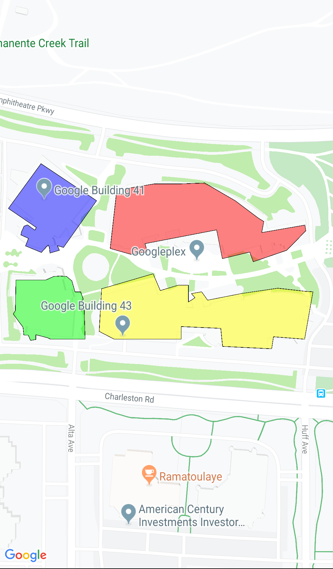
Mengimpor GeoJSON ke peta Anda
Anda dapat menyimpan fitur dalam format GeoJSON
dan menggunakan utilitas ini untuk merendernya sebagai lapisan di atas peta.
Merender data geografis dalam format GeoJSON menggunakan GMUGeoJSONParser bersama dengan GMUGeometryRenderer.
Untuk mengetahui detailnya, lihat dokumentasi di GeoJSON.
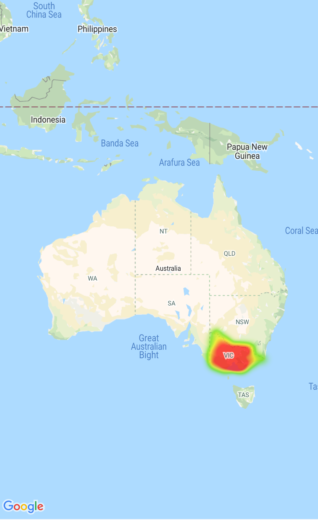
Peta Panas
Peta panas memudahkan penampil memahami distribusi dan
intensitas relatif titik data pada peta. Daripada menempatkan penanda di setiap lokasi, peta panas menggunakan warna dan bentuk untuk menampilkan distribusi data.
Gunakan delegasi GMUClusterRendererDelegate pada GMUDefaultClusterRenderer untuk menyesuaikan properti penanda sebelum dan sesudah ditambahkan ke peta.
Utilitas geometri
Kumpulan fungsi utilitas geometri sferis Swift dari modul GMSGeometryUtils Maps SDK for iOS. Gunakan ekstensi ini untuk melakukan berbagai jenis operasi geometris, termasuk:
Tentukan jarak lingkaran besar antar koordinat
Menentukan apakah koordinat berada di dalam poligon
Menentukan apakah sebuah koordinat terletak pada atau dekat jalur dalam toleransi yang ditetapkan
[null,null,["Terakhir diperbarui pada 2025-07-26 UTC."],[[["\u003cp\u003eThe Maps SDK for iOS Utility Library is an open-source library providing advanced features for your maps.\u003c/p\u003e\n"],["\u003cp\u003eThis library offers utilities for marker clustering, quadtrees, KML parsing, GeoJSON rendering, heatmaps, custom markers, and geometry operations.\u003c/p\u003e\n"],["\u003cp\u003eThe library includes a demo app demonstrating the use of each class.\u003c/p\u003e\n"],["\u003cp\u003eAccess the Maps SDK for iOS Utility Library and its documentation on GitHub.\u003c/p\u003e\n"]]],["The Maps SDK for iOS Utility Library offers tools for enhancing maps, including marker clustering via `GMUClusterManager` for managing numerous markers at different zoom levels. It also supports quadtrees for proximity searches, KML and GeoJSON format parsing for rendering geographic data, and heatmaps for visualizing data density. The library allows custom marker properties through `GMUClusterRendererDelegate` and provides geometry utilities (`GMSGeometryUtils`) for tasks like distance calculation and polygon analysis.\n"],null,["Select platform: [Android](/maps/documentation/android-sdk/utility \"View this page for the Android platform docs.\") [iOS](/maps/documentation/ios-sdk/utility \"View this page for the iOS platform docs.\")\n\nLooking for advanced features to add to your maps? The\n[Maps SDK for iOS\nUtility Library](https://github.com/googlemaps/google-maps-ios-utils) on GitHub is an open-source library of classes that are\nuseful for a range of applications. The GitHub repository includes the utility\nclasses and a demo app that illustrates the use of each class.\n\nThe utilities\n\n|----------------------------|----------------------------------------------------------------------------------------------------------------------------------------------------------------------------------------------------------------------------------------------------------------------------------------------------------------------------------------------------------------------------------------------------------------------------------------------------------------------------------------------------------------------------------------------|\n| | Marker Clustering The `GMUClusterManager` helps you manage multiple markers at different zoom levels. This means you can put a large number of markers on a map without making the map hard to read. When a user views the map at a high zoom level, the individual markers show on the map. When the user zooms out to a lower zoom level, the markers gather together into clusters, to make viewing the map easier. For details, see the documentation on the [Marker Clustering](/maps/documentation/ios-sdk/utility/marker-clustering). |\n| No image for this utility. | Quadtree A quadtree is a data structure that's useful for finding points near a single point, by searching inside an area surrounding the point of interest. For details, see the documentation on the [Quadtree](/maps/documentation/ios-sdk/utility/quadtree). |\n| | KML KML is a popular format for rendering geographic data such as points, lines, and polygons. The `GMUKMLParser` lets you parse and render geographic data in the KML format. For details, see the documentation on the [KML](/maps/documentation/ios-sdk/utility/kml). |\n| | Import GeoJSON onto your map You can store features in [GeoJSON](http://geojson.org/) format and use this utility to render them as a layer on top of a map. Render geographic data in the GeoJSON format using `GMUGeoJSONParser` in conjunction with `GMUGeometryRenderer`. For details, see the documentation on the [GeoJSON](/maps/documentation/ios-sdk/utility/geojson). |\n| | Heatmaps Heatmaps make it easy for viewers to understand the distribution and relative intensity of data points on a map. Rather than placing a marker at each location, heatmaps use color and shape to represent the distribution of data. For details, see the documentation on the [Heatmaps](/maps/documentation/ios-sdk/utility/heatmap). |\n| | Custom markers Use the delegate [`GMUClusterRendererDelegate`](https://github.com/googlemaps/google-maps-ios-utils/blob/master/src/Clustering/View/GMUDefaultClusterRenderer.h) on `GMUDefaultClusterRenderer` to customize the properties of a marker before and after it is added to the map. |\n| | Geometry utilities A set of Swift spherical geometry utility functions of the [`GMSGeometryUtils`](/maps/documentation/ios-sdk/reference/objc/Functions) module of the Maps SDK for iOS. Use these extensions to perform many types of geometric operations, including: - Determine the great circle distance between coordinates - Determine if a coordinate is inside a polygon - Determine if a coordinate lies on or near a path within a specified tolerance - Determine the area of this polygon - many others |"]]