-
ETOPO1: グローバル 1 分角の標高
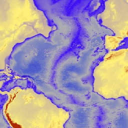
ETOPO1 は、陸地の地形と海洋の深さを統合した、地球の表面の 1 分角の全球レリーフ モデルです。これは、多数のグローバルおよびリージョンのデータセットから構築されました。これには、ice_surface と bedrock の 2 つの標高帯が含まれています。 bedrock dem elevation elevation-topography geophysical ice -
iSDAsoil Depth to Bedrock
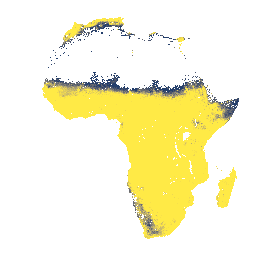
深さ 0 ~ 200 cm の基盤岩までの深さの予測平均と標準偏差。データの生成に使用された潜在的な農地マスクにより、露出した岩の多くの領域(基盤岩までの深さが 0 cm の場所)がマスクされているため、… africa bedrock isda soil
Datasets tagged bedrock in Earth Engine
[null,null,[],[],["Two datasets describe bedrock characteristics. The first, iSDAsoil Depth to Bedrock, predicts the mean and standard deviation of bedrock depth in Africa from 0-200 cm. However, areas of exposed rock may be masked due to the data generation process. The second, ETOPO1, is a global relief model integrating land and ocean data, providing two elevation bands: ice surface and bedrock, with a one arc-minute resolution.\n"]]