-
ESA WorldCereal AEZ v100
欧州宇宙機関(ESA)の WorldCereal 分類システムは、特定の栽培シーズンの終了から 1 か月以内に製品を生成することを目的としています。世界各地のこれらの栽培期間は動的であるため、農業生態区(AEZ)への世界的な層化は、… 農業 境界 作物 esa グローバル 表 -
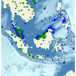
WDOECM: その他の効果的な地域ベースの保全対策(ポイント)
保護区以外の地理的に定義された地域で、生物多様性の現地での保全に長期的にプラスの効果をもたらし、関連する生態系の機能とサービスを維持し、必要に応じて地域の文化、精神、社会経済、その他の価値を維持する方法で統治および管理されているもの。 境界 生態系 iucn 海洋 mpa 保護 -
WDOECM: その他の有効な地域ベースの保全対策(ポリゴン)
保護区以外の地理的に定義された地域で、生物多様性の現地での保全に長期的にプラスの効果をもたらし、関連する生態系の機能とサービスを維持し、必要に応じて地域の文化、精神、社会経済、その他の価値を維持する方法で統治および管理されているもの。 境界 生態系 iucn 海洋 mpa 保護 -
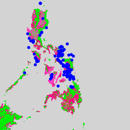
WDPA: 世界保護地域データベース(ポイント)
世界保護地域データベース(WDPA)は、保護地域に関する最新かつ完全な情報源です。政府、非政府組織、土地所有者、コミュニティからの送信データに基づいて毎月更新されます。このリストは、国連環境計画の世界保全モニタリングセンター(UNEP-WCMC)によって管理されており、次の目的で使用されています。 境界 生態系 iucn 海洋 mpa 保護 -
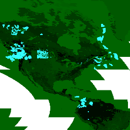
WDPA: 世界保護地域データベース(ポリゴン)
世界保護地域データベース(WDPA)は、保護地域に関する最新かつ完全な情報源です。政府、非政府組織、土地所有者、コミュニティからの送信データに基づいて毎月更新されます。このリストは、国連環境計画の世界保全モニタリングセンター(UNEP-WCMC)によって管理されており、次の目的で使用されています。 境界 生態系 iucn 海洋 mpa 保護
Datasets tagged boundaries in Earth Engine
[null,null,[],[[["\u003cp\u003eThe ESA WorldCereal classification provides monthly updates on global crop growth, stratified by Agro-Ecological Zones.\u003c/p\u003e\n"],["\u003cp\u003eThe WDOECM datasets identify areas managed for biodiversity conservation outside of designated Protected Areas, available as point and polygon data.\u003c/p\u003e\n"],["\u003cp\u003eThe WDPA datasets offer the most comprehensive and regularly updated information on protected areas worldwide, also available in point and polygon formats, managed by UNEP-WCMC.\u003c/p\u003e\n"]]],["The ESA WorldCereal classification system stratifies the globe into Agro-Ecological Zones (AEZ) to produce crop data within one month of the growing season's end. The World Database on Protected Areas (WDPA), both point and polygon versions, is a comprehensive, monthly-updated resource on protected areas. Other Effective Area-based Conservation Measures (WDOECM), also in point and polygon formats, identify areas achieving long-term biodiversity conservation, including ecosystem, cultural, and socioeconomic benefits.\n"],null,["# Datasets tagged boundaries in Earth Engine\n\n-\n\n |--------------------------------------------------------------------------------------------------------------------------------------------------------------------------------------------------------------------------------------------------------------------------------------------------------------------|\n | [### ESA WorldCereal AEZ v100](/earth-engine/datasets/catalog/ESA_WorldCereal_AEZ_v100) |\n | The European Space Agency (ESA) WorldCereal classification system aims for product generation within one month after the end of a particular growing season. Due to the dynamic nature of these growing seasons across the globe, a global stratification into Agro-Ecological Zones (AEZ) was performed based ... |\n | [agriculture](/earth-engine/datasets/tags/agriculture) [boundaries](/earth-engine/datasets/tags/boundaries) [crop](/earth-engine/datasets/tags/crop) [esa](/earth-engine/datasets/tags/esa) [global](/earth-engine/datasets/tags/global) [table](/earth-engine/datasets/tags/table) |\n\n-\n\n |-----------------------------------------------------------------------------------------------------------------------------------------------------------------------------------------------------------------------------------------------------------------------------------------------------------------------------------------|\n | [### WDOECM: Other Effective Area-based Conservation Measures (points)](/earth-engine/datasets/catalog/WCMC_WDOECM_current_points) |\n | A geographically defined area other than a Protected Area, which is governed and managed in ways that achieve positive and sustained long-term outcomes for the in situ conservation of biodiversity, with associated ecosystem functions and services and where applicable, cultural, spiritual, socio-economic, and other locally ... |\n | [boundaries](/earth-engine/datasets/tags/boundaries) [ecosystems](/earth-engine/datasets/tags/ecosystems) [iucn](/earth-engine/datasets/tags/iucn) [marine](/earth-engine/datasets/tags/marine) [mpa](/earth-engine/datasets/tags/mpa) [protected](/earth-engine/datasets/tags/protected) |\n\n-\n\n |-----------------------------------------------------------------------------------------------------------------------------------------------------------------------------------------------------------------------------------------------------------------------------------------------------------------------------------------|\n | [### WDOECM: Other Effective Area-based Conservation Measures (polygons)](/earth-engine/datasets/catalog/WCMC_WDOECM_current_polygons) |\n | A geographically defined area other than a Protected Area, which is governed and managed in ways that achieve positive and sustained long-term outcomes for the in situ conservation of biodiversity, with associated ecosystem functions and services and where applicable, cultural, spiritual, socio-economic, and other locally ... |\n | [boundaries](/earth-engine/datasets/tags/boundaries) [ecosystems](/earth-engine/datasets/tags/ecosystems) [iucn](/earth-engine/datasets/tags/iucn) [marine](/earth-engine/datasets/tags/marine) [mpa](/earth-engine/datasets/tags/mpa) [protected](/earth-engine/datasets/tags/protected) |\n\n-\n\n |------------------------------------------------------------------------------------------------------------------------------------------------------------------------------------------------------------------------------------------------------------------------------------------------------------------------------------------------------------------|\n | [### WDPA: World Database on Protected Areas (points)](/earth-engine/datasets/catalog/WCMC_WDPA_current_points) |\n | The World Database on Protected Areas (WDPA) is the most up-to-date and complete source of information on protected areas, updated monthly with submissions from governments, non-governmental organizations, landowners, and communities. It is managed by the United Nations Environment Programme's World Conservation Monitoring Centre (UNEP-WCMC) with ... |\n | [boundaries](/earth-engine/datasets/tags/boundaries) [ecosystems](/earth-engine/datasets/tags/ecosystems) [iucn](/earth-engine/datasets/tags/iucn) [marine](/earth-engine/datasets/tags/marine) [mpa](/earth-engine/datasets/tags/mpa) [protected](/earth-engine/datasets/tags/protected) |\n\n-\n\n |------------------------------------------------------------------------------------------------------------------------------------------------------------------------------------------------------------------------------------------------------------------------------------------------------------------------------------------------------------------|\n | [### WDPA: World Database on Protected Areas (polygons)](/earth-engine/datasets/catalog/WCMC_WDPA_current_polygons) |\n | The World Database on Protected Areas (WDPA) is the most up-to-date and complete source of information on protected areas, updated monthly with submissions from governments, non-governmental organizations, landowners, and communities. It is managed by the United Nations Environment Programme's World Conservation Monitoring Centre (UNEP-WCMC) with ... |\n | [boundaries](/earth-engine/datasets/tags/boundaries) [ecosystems](/earth-engine/datasets/tags/ecosystems) [iucn](/earth-engine/datasets/tags/iucn) [marine](/earth-engine/datasets/tags/marine) [mpa](/earth-engine/datasets/tags/mpa) [protected](/earth-engine/datasets/tags/protected) |"]]