-
코코아 확률 모델 2025a
참고: 이 데이터 세트는 아직 동료 검토를 거치지 않았습니다. 자세한 내용은 이 GitHub README를 참고하세요. 이 이미지 모음은 기본 영역이 상품으로 점유될 픽셀당 확률을 추정하여 제공합니다. 확률 추정치는 10m 해상도로 제공되며 …에 의해 생성되었습니다. agriculture biodiversity conservation crop eudr forestdatapartnership -
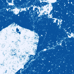
커피 확률 모델 2025a

참고: 이 데이터 세트는 아직 동료 검토를 거치지 않았습니다. 자세한 내용은 이 GitHub README를 참고하세요. 이 이미지 모음은 기본 영역이 상품으로 점유될 픽셀당 확률을 추정하여 제공합니다. 확률 추정치는 10m 해상도로 제공되며 …에 의해 생성되었습니다. agriculture biodiversity conservation crop eudr forestdatapartnership -
Farmscapes 2020

Farmscapes 2020 데이터 세트는 영국의 농업 경관 내에 있는 세 가지 주요 반자연적 특징(생울타리, 삼림, 돌담)에 대한 고해상도(25cm) 확률 지도를 제공합니다. 이 데이터 세트는 Oxford Leverhulme Centre for Nature Recovery와 협력하여 개발되었으며, … 등의 애플리케이션의 기준선으로 사용됩니다. 생물 다양성 기후 보존 산림 토지 이용-토지 피복 자연 추적 -
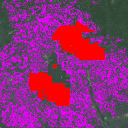
Forest Persistence v0
참고: 이 데이터 세트는 아직 동료 검토를 거치지 않았습니다. 자세한 내용은 이 모델과 연결된 GitHub README를 참고하세요. 이 이미지는 2020년에 픽셀 영역이 방해받지 않은 숲으로 구성되어 있는지 나타내는 픽셀별 점수([0, 1])를 제공합니다. 이 점수는 … 생물 다양성 보존 삼림 파괴 eudr 산림 바이오매스 forestdatapartnership -
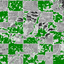
전 세계 팜유 농장 지도
이 데이터 세트는 2019년의 10m 글로벌 산업 및 소규모 자영농 야자수 지도입니다. 팜유 농장이 감지된 지역을 포함합니다. 분류된 이미지는 Sentinel-1 및 Sentinel-2 반년 합성물을 기반으로 하는 컨볼루션 신경망의 출력입니다. 자세한 내용은 도움말을 참고하세요. agriculture biodiversity conservation crop global landuse -
2020년 세계의 자연림

Natural Forests of the World 2020은 10m 해상도로 2020년의 자연림 확률을 나타내는 전 세계 지도를 제공합니다. 이 도구는 유럽 연합의 산림 파괴 방지 규정 (EUDR)과 같은 이니셔티브와 산림 보존 및 모니터링을 위한 기타 노력을 지원하기 위해 개발되었습니다. 지도 … 생물 다양성 기후 보존 삼림 파괴 eudr 산림 -
Palm Probability model 2025a

참고: 이 데이터 세트는 아직 동료 검토를 거치지 않았습니다. 자세한 내용은 이 GitHub README를 참고하세요. 이 이미지 모음은 기본 영역이 상품으로 점유될 픽셀당 확률을 추정하여 제공합니다. 확률 추정치는 10m 해상도로 제공되며 …에 의해 생성되었습니다. agriculture biodiversity conservation crop eudr forestdatapartnership -
RESOLVE Ecoregions 2017

2017년에 업데이트된 RESOLVE Ecoregions 데이터 세트는 살아있는 지구를 나타내는 846개의 육상 생태 지역을 보여줍니다. https://ecoregions2017.appspot.com/ 또는 Earth Engine에서 스타일이 지정된 지도를 확인하세요. 가장 간단한 정의에 따르면 생태지역은 지역적 범위의 생태계입니다. 구체적으로 생태지역은 … 생물 다양성 보존 생태 지역 생태계 전역 표 -
고무나무 확률 모델 2025a

참고: 이 데이터 세트는 아직 동료 검토를 거치지 않았습니다. 자세한 내용은 이 GitHub README를 참고하세요. 이 이미지 모음은 기본 영역이 상품으로 점유될 픽셀당 확률을 추정하여 제공합니다. 확률 추정치는 10m 해상도로 제공되며 …에 의해 생성되었습니다. agriculture biodiversity conservation crop eudr forestdatapartnership -
종 분포, 오스트레일리아 포유류

QCIF 및 EcoCommons와 협력하여 Google에서 개발한 이러한 종 분포 모델 출력은 종의 상대적 발생 가능성 추정치를 나타냅니다.즉, 값이 높을수록 특정 조사 방법론과 특정 조사 기간에 해당 위치에서 종이 발견될 가능성이 높습니다. 생물 다양성 보존 생태계 자연 추적 사전 검토 게시자 데이터 세트
Datasets tagged conservation in Earth Engine
[null,null,[],[],["The datasets include a 2019 global map of industrial and smallholder oil palm plantations derived from Sentinel-1 and Sentinel-2 data, and a 2017 depiction of 846 terrestrial ecoregions. Additionally, there are per-pixel probability models at 10-meter resolution for cocoa, palm, and rubber tree occupancy, as well as a 2020 per-pixel score indicating undisturbed forest areas. Each model is associated with GitHub README for additional information.\n"]]