-
MERIT Hydro:全球水文数据集
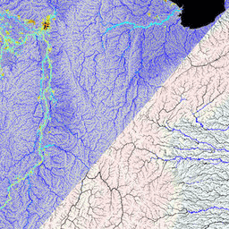
MERIT Hydro 是一张新的全球水流方向图,分辨率为 3 角秒(赤道处约为 90 米),基于 MERIT DEM 海拔数据和水体数据集(G1WBM、GSWO 和 OpenStreetMap)的 1.0.3 版得出。MERIT Hydro 包含新 … 的输出 dem elevation flow-direction hand hydrography hydrosheds -
MERIT Hydro:补充可视化图层

MERIT Hydro 的补充可视化图层 dem elevation flow-direction hand hydrography hydrosheds
Datasets tagged hand in Earth Engine
[null,null,[],[],[]]