Page Summary
-
Proba-V is a satellite mission designed to map land cover and vegetation growth, providing continuity for the VGT optical instrument.
-
The Proba-V sensor collects data in three visible and near-infrared bands and one short-wave infrared band.
-
Planet SkySat Public Ortho Imagery was collected for experimental programs, crisis response, and other projects.
-
SkySat data is available in both a 5-band Multispectral/Pan collection.
-
Brazil Forest Imagery Dataset 2008: Analytic Basemap
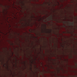
This dataset provides up to a 10-meter resolution multispectral (green, red, and near-infrared) basemap of Brazil, primarily captured in 2008, to support implementation of the Brazil Forest Code. The mosaic is synthesized from SPOT 2, 4, and 5 satellite data. It serves as a higher-resolution … brazil forest-code google imagery multispectral satellite-imagery -
PROBA-V C1 Top Of Canopy Daily Synthesis 100m
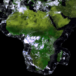
Proba-V is a satellite mission tasked to map land cover and vegetation growth. It was designed to provide continuity for the VGT optical instrument from the SPOT-4 and SPOT-5 missions. The sensor collects data in three VNIR (visible and near-infrared) bands and one SWIR (short-wave … esa multispectral nir proba probav satellite-imagery -
PROBA-V C1 Top Of Canopy Daily Synthesis 333m

Proba-V is a satellite mission tasked to map land cover and vegetation growth. It was designed to provide continuity for the VGT optical instrument from the SPOT-4 and SPOT-5 missions. The sensor collects data in three VNIR (visible and near-infrared) bands and one SWIR (short-wave … esa multispectral nir proba probav satellite-imagery -
Planet SkySat Public Ortho Imagery, Multispectral
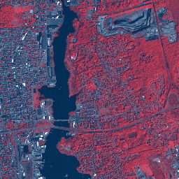
This data from Planet labs Inc. SkySat satellites was collected for the experimental "Skybox for Good Beta" program in 2015, as well as for various crisis response events and a few other projects. The data is available in both a 5-band Multispectral/Pan collection, and a … highres multispectral pansharpened planet satellite-imagery skysat -
SPOT Multispectral Imagery 10-20m, Brazil

This collection provides 2008-era raw multispectral imagery from the SPOT 2, 4, and 5 satellites over the country of Brazil. These missions, operated by CNES, were designed to provide high-resolution, wide-area optical imagery for managing Earth's resources. SPOT 2 and 4 utilized HRV and HRVIR … brazil forest-code google multispectral satellite-imagery spot