-
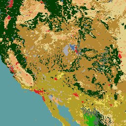
北米の土地被覆(30 m、2020 年)
2020 年の北米の土地被覆 30 メートル データセットは、カナダ天然資源省、米国地質調査所、メキシコの統計地理研究所を含む 3 つのメキシコ組織による三国共同の北米土地変化モニタリング システム(NALCMS)の一環として作成されました。 landcover landsat landuse-landcover nlcd reflectance -
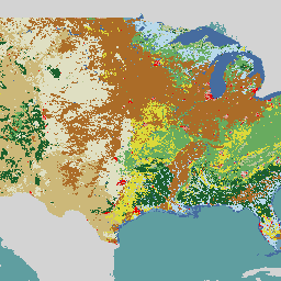
NLCD 2019: USGS 国土被覆データベース、2019 年リリース
NLCD(National Land Cover Database)は、8 つのエポック(2001、2004、2006、2008、2011、2013、2016、2019)にまたがる 30 m の Landsat ベースの土地被覆データベースです。2021 年の第 9 エポックもこちらで入手できます。画像は、都市部の不浸透性データレイヤに基づいています。 blm landcover landuse-landcover mrlc nlcd usgs -
NLCD 2021: USGS 国土被覆データベース、2021 年リリース
米国地質調査所(USGS)は、複数の連邦機関と提携して、7 つの国立土地被覆データベース(NLCD)プロダクト(NLCD 1992、2001、2006、2011、2016、2019、2021)を開発し、リリースしました。2016 年のリリース以降、土地被覆プロダクトは 2 ~ 3 年ごとに作成されています。 blm landcover landuse-landcover mrlc nlcd usgs -
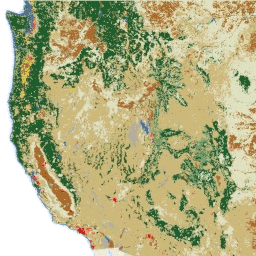
RCMAP 放牧地コンポーネントの時系列(1985 ~ 2023)、v06
「RCMAP(Rangeland Condition Monitoring Assessment and Projection)データセットは、1985 ~ 2023 年の Landsat 画像を使用して、北米西部における牧草地コンポーネントの被覆率を定量化しています。RCMAP プロダクト スイートは、10 個の分数コンポーネント(一年生草本、裸地、草本、落葉、サボテン以外の低木、多年生草本、サボテンなど)で構成されています。 climate-change disturbance landsat-derived landuse-landcover nlcd rangeland -
RCMAP 草地の傾向年(1985 ~ 2023)、コンポーネントの時系列、v06
このコレクションには、1985 年から 2023 年までの RCMAP 年次プロダクトが含まれています。RCMAP(Rangeland Condition Monitoring Assessment and Projection)データセットは、1985 ~ 2023 年の Landsat 画像を使用して、北米西部における牧草地コンポーネントの被覆率を定量化しています。RCMAP プロダクト スイートは、年間 … の 10 個の部分で構成されています。 climate-change disturbance landsat-derived landuse-landcover nlcd rangeland -
RCMAP コンポーネントの時系列の範囲の傾向(1985 ~ 2023)、v06
RCMAP(Rangeland Condition Monitoring Assessment and Projection)データセットは、1985 ~ 2023 年の Landsat 画像を使用して、北米西部における牧草地コンポーネントの被覆率を定量化しています。RCMAP プロダクト スイートは、10 個の分数コンポーネント(一年生草本、裸地、草本、落葉、サボテン以外の低木、多年生草本、サボテンなど)で構成されています。 climate-change disturbance landsat-derived landuse-landcover nlcd rangeland
Datasets tagged nlcd in Earth Engine
[null,null,[],[[["\u003cp\u003eThe National Land Cover Database (NLCD) provides 30-meter resolution land cover data for the U.S. from 1992 to 2021, with the 2016 release onwards offering data in two-to-three-year intervals.\u003c/p\u003e\n"],["\u003cp\u003eThe North American Land Cover 30-meter dataset for 2020 is a collaborative effort between the U.S., Canada, and Mexico to monitor land cover changes across the continent.\u003c/p\u003e\n"],["\u003cp\u003eThe Rangeland Condition Monitoring Assessment and Projection (RCMAP) dataset quantifies percent cover of rangeland components in western North America from 1985 to 2023 using Landsat imagery, including trends analysis.\u003c/p\u003e\n"],["\u003cp\u003eRCMAP data includes ten fractional components such as annual herbaceous, bare ground, herbaceous, litter, non-sagebrush shrub, perennial herbaceous, sagebrush, and more, allowing for detailed rangeland analysis.\u003c/p\u003e\n"]]],[],null,["# Datasets tagged nlcd in Earth Engine\n\n-\n\n |------------------------------------------------------------------------------------------------------------------------------------------------------------------------------------------------------------------------------------------------------------------------------------------------------------------------------------|\n | [### Land Cover of North America at 30 meters, 2020](/earth-engine/datasets/catalog/USGS_NLCD_RELEASES_2020_REL_NALCMS) |\n | The 2020 North American Land Cover 30-meter dataset was produced as part of the North American Land Change Monitoring System (NALCMS), a trilateral effort between Natural Resources Canada, the United States Geological Survey, and three Mexican organizations including the National Institute of Statistics and Geography ... |\n | [landcover](/earth-engine/datasets/tags/landcover) [landsat](/earth-engine/datasets/tags/landsat) [landuse-landcover](/earth-engine/datasets/tags/landuse-landcover) [nlcd](/earth-engine/datasets/tags/nlcd) [reflectance](/earth-engine/datasets/tags/reflectance) |\n\n-\n\n |-----------------------------------------------------------------------------------------------------------------------------------------------------------------------------------------------------------------------------------------------------------------------------------------|\n | [### NLCD 2019: USGS National Land Cover Database, 2019 release](/earth-engine/datasets/catalog/USGS_NLCD_RELEASES_2019_REL_NLCD) |\n | NLCD (the National Land Cover Database) is a 30-m Landsat-based land cover database spanning 8 epochs (2001, 2004, 2006, 2008, 2011, 2013, 2016, and 2019). A ninth epoch for 2021 is also available here. The images rely on the imperviousness data layer for the urban ... |\n | [blm](/earth-engine/datasets/tags/blm) [landcover](/earth-engine/datasets/tags/landcover) [landuse-landcover](/earth-engine/datasets/tags/landuse-landcover) [mrlc](/earth-engine/datasets/tags/mrlc) [nlcd](/earth-engine/datasets/tags/nlcd) [usgs](/earth-engine/datasets/tags/usgs) |\n\n-\n\n |------------------------------------------------------------------------------------------------------------------------------------------------------------------------------------------------------------------------------------------------------------------------------------------------------------------------------|\n | [### NLCD 2021: USGS National Land Cover Database, 2021 release](/earth-engine/datasets/catalog/USGS_NLCD_RELEASES_2021_REL_NLCD) |\n | The U.S. Geological Survey (USGS), in partnership with several federal agencies, has now developed and released seven National Land Cover Database (NLCD) products: NLCD 1992, 2001, 2006, 2011, 2016, 2019, and 2021. Beginning with the 2016 release, land cover products were created for two-to-three-year intervals ... |\n | [blm](/earth-engine/datasets/tags/blm) [landcover](/earth-engine/datasets/tags/landcover) [landuse-landcover](/earth-engine/datasets/tags/landuse-landcover) [mrlc](/earth-engine/datasets/tags/mrlc) [nlcd](/earth-engine/datasets/tags/nlcd) [usgs](/earth-engine/datasets/tags/usgs) |\n\n-\n\n |------------------------------------------------------------------------------------------------------------------------------------------------------------------------------------------------------------------------------------------------------------------------------------------------------------------------------------------------------------------------------------|\n | [### RCMAP Rangeland Component Timeseries (1985-2023), v06](/earth-engine/datasets/catalog/USGS_NLCD_RELEASES_2023_REL_RCMAP_V6_COVER) |\n | 'The RCMAP (Rangeland Condition Monitoring Assessment and Projection) dataset quantifies the percent cover of rangeland components across western North America using Landsat imagery from 1985-2023. The RCMAP product suite consists of ten fractional components: annual herbaceous, bare ground, herbaceous, litter, non-sagebrush shrub, perennial herbaceous, sagebrush, ... |\n | [climate-change](/earth-engine/datasets/tags/climate-change) [disturbance](/earth-engine/datasets/tags/disturbance) [landsat-derived](/earth-engine/datasets/tags/landsat-derived) [landuse-landcover](/earth-engine/datasets/tags/landuse-landcover) [nlcd](/earth-engine/datasets/tags/nlcd) [rangeland](/earth-engine/datasets/tags/rangeland) |\n\n-\n\n |-------------------------------------------------------------------------------------------------------------------------------------------------------------------------------------------------------------------------------------------------------------------------------------------------------------------------------------------------------|\n | [### RCMAP Rangeland Trends Year for Component Timeseries (1985-2023), v06](/earth-engine/datasets/catalog/USGS_NLCD_RELEASES_2023_REL_RCMAP_V6_TRENDS_YEAR) |\n | This collection includes RCMAP yearly products from 1985 through 2023. The RCMAP (Rangeland Condition Monitoring Assessment and Projection) dataset quantifies the percent cover of rangeland components across western North America using Landsat imagery from 1985-2023. The RCMAP product suite consists of ten fractional components: annual ... |\n | [climate-change](/earth-engine/datasets/tags/climate-change) [disturbance](/earth-engine/datasets/tags/disturbance) [landsat-derived](/earth-engine/datasets/tags/landsat-derived) [landuse-landcover](/earth-engine/datasets/tags/landuse-landcover) [nlcd](/earth-engine/datasets/tags/nlcd) [rangeland](/earth-engine/datasets/tags/rangeland) |\n\n-\n\n |-----------------------------------------------------------------------------------------------------------------------------------------------------------------------------------------------------------------------------------------------------------------------------------------------------------------------------------------------------------------------------------|\n | [### RCMAP Rangeland Trends for Component Timeseries (1985-2023), v06](/earth-engine/datasets/catalog/USGS_NLCD_RELEASES_2023_REL_RCMAP_V6_TRENDS) |\n | The RCMAP (Rangeland Condition Monitoring Assessment and Projection) dataset quantifies the percent cover of rangeland components across western North America using Landsat imagery from 1985-2023. The RCMAP product suite consists of ten fractional components: annual herbaceous, bare ground, herbaceous, litter, non-sagebrush shrub, perennial herbaceous, sagebrush, ... |\n | [climate-change](/earth-engine/datasets/tags/climate-change) [disturbance](/earth-engine/datasets/tags/disturbance) [landsat-derived](/earth-engine/datasets/tags/landsat-derived) [landuse-landcover](/earth-engine/datasets/tags/landuse-landcover) [nlcd](/earth-engine/datasets/tags/nlcd) [rangeland](/earth-engine/datasets/tags/rangeland) |"]]