-
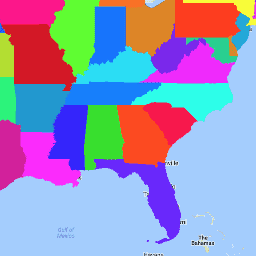
TIGER:2016 年美国人口普查州级数据
美国人口普查局 TIGER 数据集包含美国主要政府行政区划的 2016 年边界。除了 50 个州之外,美国人口普查局还将哥伦比亚特区、波多黎各和每个岛屿地区(美属萨摩亚、美属维尔京群岛、关岛、北马里亚纳群岛、美属 … census infrastructure-boundaries state states table tiger -
TIGER:2018 年美国人口普查州级数据
美国人口普查局 TIGER 数据集包含 2018 年美国主要政府行政区划的边界。除了 50 个州之外,美国人口普查局还将哥伦比亚特区、波多黎各和每个岛屿地区(美属萨摩亚、美属维尔京群岛、关岛、北马里亚纳群岛、美属 … census infrastructure-boundaries state states table tiger
Datasets tagged state in Earth Engine
[null,null,[],[[["\u003cp\u003eThe US Census Bureau TIGER dataset provides boundaries for the primary governmental divisions of the United States, including states, the District of Columbia, Puerto Rico, and island areas.\u003c/p\u003e\n"],["\u003cp\u003eThe dataset is available for the years 2016 and 2018.\u003c/p\u003e\n"],["\u003cp\u003eBoundaries encompass the fifty states as well as the District of Columbia, Puerto Rico, and island areas like American Samoa, the Commonwealth of the Northern Mariana Islands, Guam, and the U.S. Virgin Islands.\u003c/p\u003e\n"]]],[],null,["# Datasets tagged state in Earth Engine\n\n-\n\n |---------------------------------------------------------------------------------------------------------------------------------------------------------------------------------------------------------------------------------------------------------------------------------------------------------------|\n | [### TIGER: US Census States 2016](/earth-engine/datasets/catalog/TIGER_2016_States) |\n | The United States Census Bureau TIGER dataset contains the 2016 boundaries for the primary governmental divisions of the United States. In addition to the fifty states, the Census Bureau treats the District of Columbia, Puerto Rico, and each of the island areas (American Samoa, the ... |\n | [census](/earth-engine/datasets/tags/census) [infrastructure-boundaries](/earth-engine/datasets/tags/infrastructure-boundaries) [state](/earth-engine/datasets/tags/state) [states](/earth-engine/datasets/tags/states) [table](/earth-engine/datasets/tags/table) [tiger](/earth-engine/datasets/tags/tiger) |\n\n-\n\n |---------------------------------------------------------------------------------------------------------------------------------------------------------------------------------------------------------------------------------------------------------------------------------------------------------------|\n | [### TIGER: US Census States 2018](/earth-engine/datasets/catalog/TIGER_2018_States) |\n | The United States Census Bureau TIGER dataset contains the 2018 boundaries for the primary governmental divisions of the United States. In addition to the fifty states, the Census Bureau treats the District of Columbia, Puerto Rico, and each of the island areas (American Samoa, the ... |\n | [census](/earth-engine/datasets/tags/census) [infrastructure-boundaries](/earth-engine/datasets/tags/infrastructure-boundaries) [state](/earth-engine/datasets/tags/state) [states](/earth-engine/datasets/tags/states) [table](/earth-engine/datasets/tags/table) [tiger](/earth-engine/datasets/tags/tiger) |"]]