-
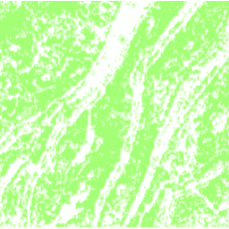
DESS China Terrace Map v1
이 데이터 세트는 2018년 중국 테라스 지도로 해상도는 30m입니다. 이 모델은 Google Earth Engine 플랫폼을 기반으로 다중 소스 및 다중 시점 데이터를 사용하는 감독형 픽셀 기반 분류를 통해 개발되었습니다. 전반적인 정확도와 카파 계수는 각각 94% 와 0.72를 달성했습니다. 이 첫 번째 … agriculture landcover landuse landuse-landcover tsinghua -
칭화 FROM-GLC 불투수 표면으로 변경 연도
이 데이터 세트에는 1985년부터 2018년까지 전 세계 불투수 표면적의 연간 변화 정보가 30m 해상도로 포함되어 있습니다. 투수성에서 불투수성으로의 변화는 감독 분류와 시간적 일관성 확인의 결합된 접근 방식을 사용하여 결정되었습니다. 불투명 픽셀은 불투명도가 50% 를 초과하는 것으로 정의됩니다. … 건축 인구 칭화 도시
Datasets tagged tsinghua in Earth Engine
[null,null,[],[[["\u003cp\u003eThe DESS China Terrace Map provides a 30m resolution view of terrace farming across China in 2018, achieving high accuracy through supervised classification using multi-source data.\u003c/p\u003e\n"],["\u003cp\u003eThe Tsinghua FROM-GLC dataset offers insights into annual changes in global impervious surfaces from 1985 to 2018 at 30m resolution, identifying areas where pervious land has become impervious.\u003c/p\u003e\n"]]],["Two datasets are described: a 2018 China terrace map at 30m resolution, created via supervised pixel-based classification using multisource and multi-temporal data. The method had an overall accuracy of 94% and a kappa coefficient of 0.72. The second dataset provides annual changes in global impervious surface area, from 1985 to 2018 at 30m resolution. This was done by a combination of supervised classification and temporal consistency checking. Impervious pixels are above 50% impervious.\n"],null,["# Datasets tagged tsinghua in Earth Engine\n\n-\n\n |--------------------------------------------------------------------------------------------------------------------------------------------------------------------------------------------------------------------------------------------------------------------------------------------------------------------|\n | [### DESS China Terrace Map v1](/earth-engine/datasets/catalog/Tsinghua_DESS_ChinaTerraceMap_v1) |\n | This dataset is a China terrace map at 30 m resolution in 2018. It was developed through supervised pixel-based classification using multisource and multi-temporal data based on the Google Earth Engine platform. The overall accuracy and kappa coefficient achieved 94% and 0.72, respectively. This first ... |\n | [agriculture](/earth-engine/datasets/tags/agriculture) [landcover](/earth-engine/datasets/tags/landcover) [landuse](/earth-engine/datasets/tags/landuse) [landuse-landcover](/earth-engine/datasets/tags/landuse-landcover) [tsinghua](/earth-engine/datasets/tags/tsinghua) |\n\n-\n\n |---------------------------------------------------------------------------------------------------------------------------------------------------------------------------------------------------------------------------------------------------------------------------------------------------------------------------------|\n | [### Tsinghua FROM-GLC Year of Change to Impervious Surface](/earth-engine/datasets/catalog/Tsinghua_FROM-GLC_GAIA_v10) |\n | This dataset contains annual change information of global impervious surface area from 1985 to 2018 at a 30m resolution. Change from pervious to impervious was determined using a combined approach of supervised classification and temporal consistency checking. Impervious pixels are defined as above 50% impervious. ... |\n | [built](/earth-engine/datasets/tags/built) [population](/earth-engine/datasets/tags/population) [tsinghua](/earth-engine/datasets/tags/tsinghua) [urban](/earth-engine/datasets/tags/urban) |"]]