Announcement: All noncommercial projects registered to use Earth Engine before April 15, 2025 must verify noncommercial eligibility to maintain Earth Engine access.
Stay organized with collections
Save and categorize content based on your preferences.
Created by Earth Engine users, for Earth Engine users, tutorials in this section
are intended for all levels, from beginner guides to walk throughs of more
advanced techniques.
If you are interested in contributing a tutorial, please visit the
Writing a Tutorial page for
instructions.
[null,null,["Last updated 2024-03-19 UTC."],[[["\u003cp\u003eThis section provides user-generated Earth Engine tutorials covering beginner to advanced topics, not official product documentation.\u003c/p\u003e\n"],["\u003cp\u003eTutorials cover a wide range of topics, including image analysis, time series analysis, web app creation, and machine learning techniques applied to geospatial data.\u003c/p\u003e\n"],["\u003cp\u003eUsers are encouraged to contribute their own tutorials following the provided guidelines.\u003c/p\u003e\n"],["\u003cp\u003eThe tutorials are categorized by programming language, including JavaScript and Python, offering flexibility for users with different coding backgrounds.\u003c/p\u003e\n"],["\u003cp\u003eAll tutorials offer practical, hands-on examples and workflows to help users learn and apply Earth Engine to their specific research or projects.\u003c/p\u003e\n"]]],[],null,["# Community Tutorials\n\n| Content produced by the Earth Engine developer community is not part of the official Earth Engine product documentation.\n\nCreated by Earth Engine users, for Earth Engine users, tutorials in this section\nare intended for all levels, from beginner guides to walk throughs of more\nadvanced techniques.\n\nIf you are interested in contributing a tutorial, please visit the\n[Writing a Tutorial](/earth-engine/tutorials/community/write) page for\ninstructions.\n\n
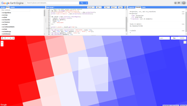
JavaScript Code Editor API tutorials\n------------------------------------\n\n[](/earth-engine/tutorials/community/anomalies-analysis-smo-and-pre) \n[#### 
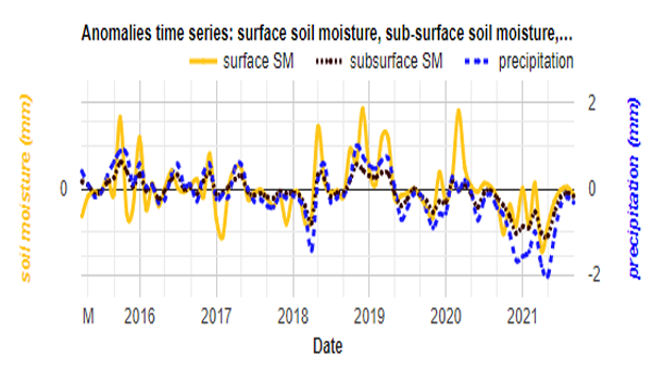
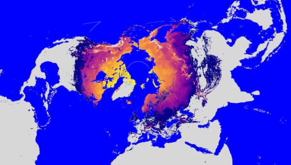
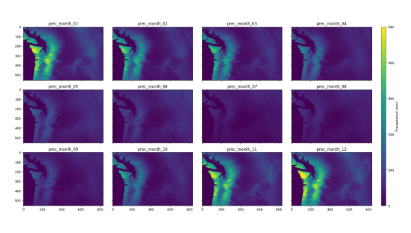
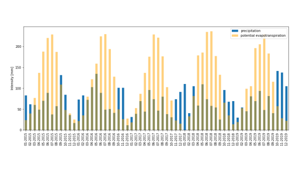
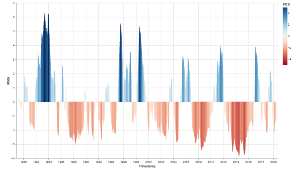
Anomalies Analysis of Soil Moisture and Precipitation](/earth-engine/tutorials/community/anomalies-analysis-smo-and-pre)\n\n\nSoil moisture and precipitation analysis to identify prolonged drought. \n[](/earth-engine/tutorials/community/beginners-cookbook) \n[#### Beginner's Cookbook](/earth-engine/tutorials/community/beginners-cookbook)\n\n\nOverview of common Earth Engine classes and methods. \n[](/earth-engine/tutorials/community/combining-feature-collections) \n[#### Combining FeatureCollections](/earth-engine/tutorials/community/combining-feature-collections)\n\n\nHow to combine two FeatureCollections into one. \n[](/earth-engine/tutorials/community/creating-web-apps) \n[#### Creating Web Apps](/earth-engine/tutorials/community/creating-web-apps)\n\n\nBuild an Earth Engine App with custom layer selection and data inspection functionality. \n[](/earth-engine/tutorials/community/customizing-base-map-styles) \n[#### Customizing Base Map Styles](/earth-engine/tutorials/community/customizing-base-map-styles)\n\n\nHow to change the Code Editor's base map properties. \n[](/earth-engine/tutorials/community/introduction-to-dynamic-world-pt-1) \n[#### Dynamic World (Part 1)](/earth-engine/tutorials/community/introduction-to-dynamic-world-pt-1)\n\n\nVisualizing the Dynamic World dataset and creating composites. \n[](/earth-engine/tutorials/community/introduction-to-dynamic-world-pt-2) \n[#### Dynamic World (Part 2)](/earth-engine/tutorials/community/introduction-to-dynamic-world-pt-2)\n\n\nCalculating zonal statistics from the Dynamic World dataset. \n[](/earth-engine/tutorials/community/introduction-to-dynamic-world-pt-3) \n[#### 
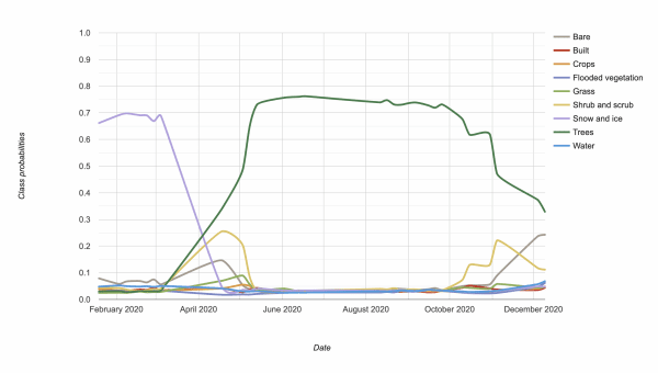
Dynamic World (Part 3)](/earth-engine/tutorials/community/introduction-to-dynamic-world-pt-3)\n\n\nExploring the Dynamic World dataset time series. \n[](/earth-engine/tutorials/community/extract-raster-values-for-points) \n[#### 
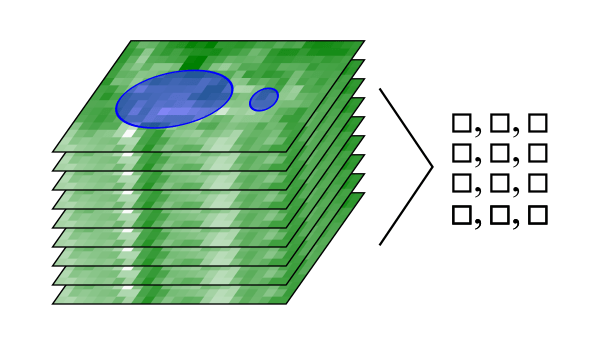
Extracting Raster Values for Points](/earth-engine/tutorials/community/extract-raster-values-for-points)\n\n\nCalculating and arranging zonal statistics for image time series data as a tidy table. \n[](/earth-engine/tutorials/community/forest-cover-loss-estimation) \n[#### 
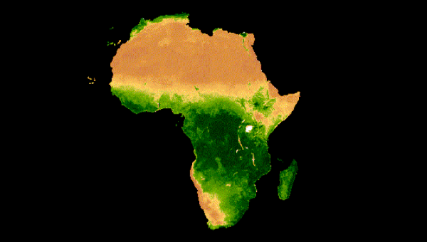
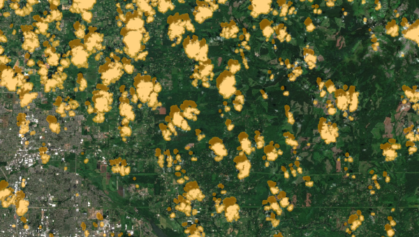
Forest Cover and Loss Estimation](/earth-engine/tutorials/community/forest-cover-loss-estimation)\n\n\nEstimate tree area and loss based Hansen's Global Forest Change dataset. \n[](/earth-engine/tutorials/community/drawing-tools) \n[#### Getting Started with Drawing Tools](/earth-engine/tutorials/community/drawing-tools)\n\n\nHow to use the Code Editor's drawing tools API. \n[](/earth-engine/tutorials/community/histarfm-cloud-and-gap-free-landsat) \n[#### HISTARFM - How to Work with Gap-Filled Imagery](/earth-engine/tutorials/community/histarfm-cloud-and-gap-free-landsat)\n\n\nExperiment with a collection of monthly Landsat gap-filled data from the HISTARFM data fusion system. \n[](/earth-engine/tutorials/community/identifying-first-day-no-snow) \n[#### Identifying Annual First Day of No Snow Cover](/earth-engine/tutorials/community/identifying-first-day-no-snow)\n\n\nUse MODIS NDSI to map the annual first day of no snow cover. \n[](/earth-engine/tutorials/community/drawing-tools-region-reduction) \n[#### 
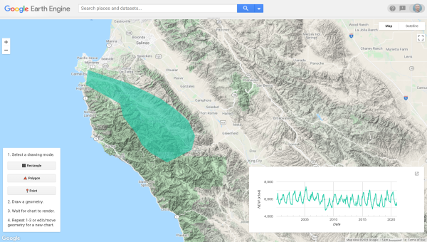
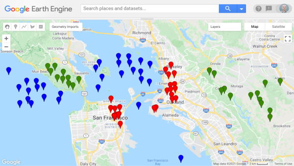
Interactive Region Reduction App](/earth-engine/tutorials/community/drawing-tools-region-reduction)\n\n\nCustom drawing tools to simplify interactive regional time series charting. \n[](/earth-engine/tutorials/community/smap-soil-moisture) \n[#### 
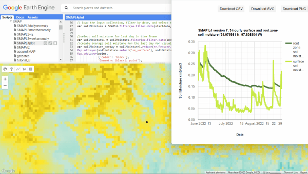
Introduction to Soil Moisture Active Passive (SMAP)](/earth-engine/tutorials/community/smap-soil-moisture)\n\n\nLearn how to visualize and analyze SMAP soil moisture data. \n[](/earth-engine/tutorials/community/ph-ug-temp) \n[#### 
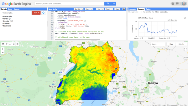
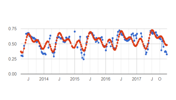
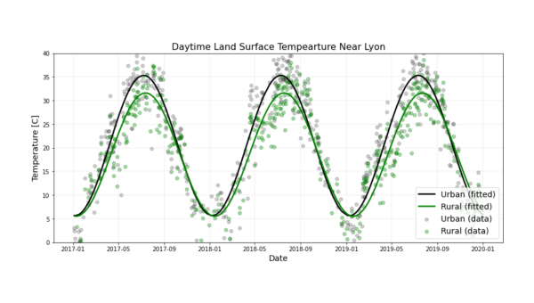
Land Surface Temperature in Uganda](/earth-engine/tutorials/community/ph-ug-temp)\n\n\nChart a temperature time series and make a map of temperature. \n[](/earth-engine/tutorials/community/modis-ndvi-time-series-animation) \n[#### MODIS NDVI Times Series Animation](/earth-engine/tutorials/community/modis-ndvi-time-series-animation)\n\n\nGenerate an animated GIF showing seasonal vegetation change. \n[](/earth-engine/tutorials/community/forest-vegetation-condition) \n[#### 
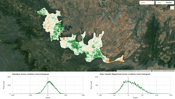
Monitoring Forest Vegetation Condition](/earth-engine/tutorials/community/forest-vegetation-condition)\n\n\nForest vegetation status over time and linear trend analysis. \n[](/earth-engine/tutorials/community/nonparametric-trends) \n[#### 
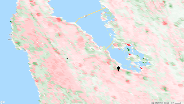
Non-Parametric Trend Analysis](/earth-engine/tutorials/community/nonparametric-trends)\n\n\nMann-Kendall test, Sen's slope, and statistical significance. \n[](/earth-engine/tutorials/community/pseudo-invariant-feature-matching) \n[#### 
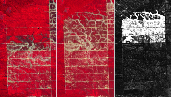
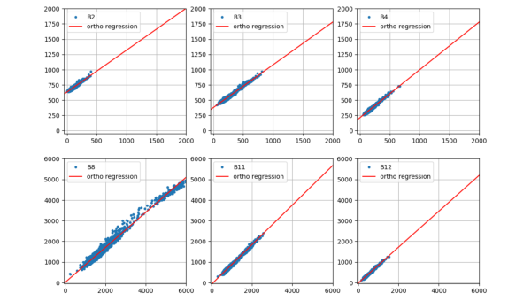
Pseudo-Invariant Feature Matching](/earth-engine/tutorials/community/pseudo-invariant-feature-matching)\n\n\nRelative radiometric normalization using pseudo-invariant feature matching. \n[](/earth-engine/tutorials/community/classify-maizeland-ng) \n[#### 
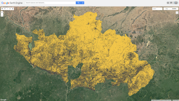
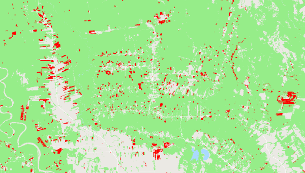
Rapid Classification of Croplands](/earth-engine/tutorials/community/classify-maizeland-ng)\n\n\nRapid and replicable binary classification of maize-cultivated land in Nigeria. \n[](/earth-engine/tutorials/community/spatiotemporal-image-statistics) \n[#### Spatiotemporal Statistics of Vegetation Indices](/earth-engine/tutorials/community/spatiotemporal-image-statistics)\n\n\nCalculate zonal statistics over time and export as long and wide tables in comma delimited format. \n[](/earth-engine/tutorials/community/sar-basics) \n[#### 
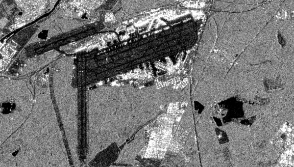
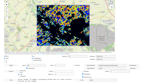
Synthetic Aperture Radar (SAR) Basics](/earth-engine/tutorials/community/sar-basics)\n\n\nIntroduction to synthetic aperture Radar (SAR) basics using Sentinel-1. \n[](/earth-engine/tutorials/community/time-series-modeling) \n[#### Time Series Modeling](/earth-engine/tutorials/community/time-series-modeling)\n\n\nFundamentals of time series modeling.\n\nPython API tutorials\n--------------------\n\n[](/earth-engine/tutorials/community/intro-to-python-api) \n[#### An Intro to the Earth Engine Python API](/earth-engine/tutorials/community/intro-to-python-api)\n\n\nA sample of analyses and techniques for working with Python API. \n[](/earth-engine/tutorials/community/data-converters) \n[#### Data Converters](/earth-engine/tutorials/community/data-converters)\n\n\nConvert Earth Engine data to DataFrame, GeoDataFrame, and NumPy structured array. \n[](/earth-engine/tutorials/community/detecting-changes-in-sentinel-1-imagery-pt-1) \n[#### 
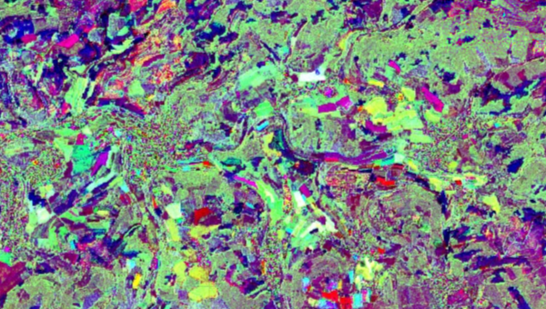
Detecting Changes in Sentinel-1 Imagery (Part 1)](/earth-engine/tutorials/community/detecting-changes-in-sentinel-1-imagery-pt-1)\n\n\nSynthetic aperture radar (SAR) imagery: single and multi-look image statistics. \n[](/earth-engine/tutorials/community/detecting-changes-in-sentinel-1-imagery-pt-2) \n[#### 
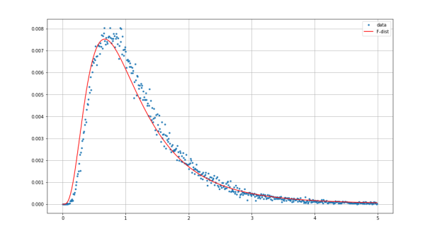
Detecting Changes in Sentinel-1 Imagery (Part 2)](/earth-engine/tutorials/community/detecting-changes-in-sentinel-1-imagery-pt-2)\n\n\nSynthetic aperture radar (SAR) imagery: hypothesis testing. \n[](/earth-engine/tutorials/community/detecting-changes-in-sentinel-1-imagery-pt-3) \n[#### 
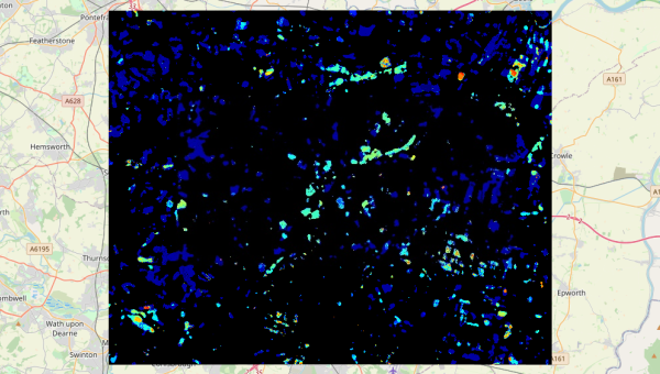
Detecting Changes in Sentinel-1 Imagery (Part 3)](/earth-engine/tutorials/community/detecting-changes-in-sentinel-1-imagery-pt-3)\n\n\nSynthetic aperture radar (SAR) imagery: multitemporal change detection. \n[](/earth-engine/tutorials/community/detecting-changes-in-sentinel-1-imagery-pt-4) \n[#### Detecting Changes in Sentinel-1 Imagery (Part 4)](/earth-engine/tutorials/community/detecting-changes-in-sentinel-1-imagery-pt-4)\n\n\nSynthetic aperture radar (SAR) imagery: explorer widget. \n[](/earth-engine/tutorials/community/groundwater-recharge-estimation) \n[#### Groundwater Recharge Estimation](/earth-engine/tutorials/community/groundwater-recharge-estimation)\n\n\nImplementation of the Thornthwaite-Mather procedure to map groundwater recharge. \n[](/earth-engine/tutorials/community/histogram-matching) \n[#### Histogram Matching](/earth-engine/tutorials/community/histogram-matching)\n\n\nA method for altering the appearance of one image to match another. \n[](/earth-engine/tutorials/community/imad-tutorial-pt1) \n[#### 
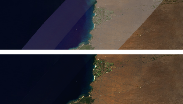
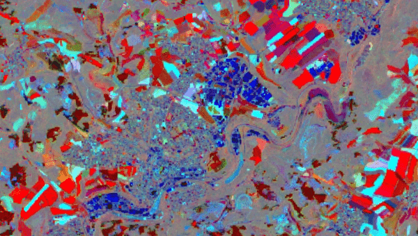
Change Detection in GEE - The MAD Transformation (Part 1)](/earth-engine/tutorials/community/imad-tutorial-pt1)\n\n\nIteratively re-weighted Multivariate Alteration Detection. \n[](/earth-engine/tutorials/community/imad-tutorial-pt2) \n[#### Change Detection in GEE - The MAD Transformation (Part 2)](/earth-engine/tutorials/community/imad-tutorial-pt2)\n\n\nIteratively re-weighted Multivariate Alteration Detection. \n[](/earth-engine/tutorials/community/imad-tutorial-pt3) \n[#### Change Detection in GEE - The MAD Transformation (Part 3)](/earth-engine/tutorials/community/imad-tutorial-pt3)\n\n\nIteratively re-weighted Multivariate Alteration Detection. \n[](/earth-engine/tutorials/community/sentinel-2-s2cloudless) \n[#### Sentinel-2 Cloud Masking with s2cloudless](/earth-engine/tutorials/community/sentinel-2-s2cloudless)\n\n\nMasking clouds and cloud shadows in Sentinel-2 surface reflectance imagery. \n[](/earth-engine/tutorials/community/species-distribution-modeling) \n[#### 
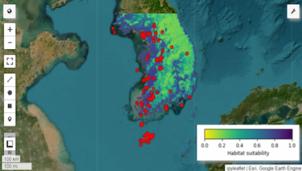
Species Distribution Modeling](/earth-engine/tutorials/community/species-distribution-modeling)\n\n\nA workflow for predicting species distribution. \n[](/earth-engine/tutorials/community/time-series-visualization-with-altair) \n[#### Time Series Visualization with Altair](/earth-engine/tutorials/community/time-series-visualization-with-altair)\n\n\nGenerating time series data and visualizing it with the Altair library using drought and vegetation response."]]