-
世界のマングローブ林の分布、v1(2000)
このデータベースは、2000 年の Landsat 衛星データを使用して作成されました。USGS 地球資源観測科学センター(EROS)から取得した 1,000 を超える Landsat シーンが、教師あり学習と教師なし学習を組み合わせたデジタル画像分類手法を使用して分類されました。このデータベースは、最初の、最も … 年次 CIESIN 森林バイオマス 世界 Landsat 由来 マングローブ -
JRC 年間水域分類履歴、v1.4
このデータセットには、1984 年から 2021 年までの地表水の位置と時間分布の地図が含まれており、それらの水域の範囲と変化に関する統計情報が提供されています。詳細については、関連するジャーナル記事「High-resolution mapping of global surface water and its …」をご覧ください。 年次 地理物理 Google 履歴 jrc landsat 由来 -
MOD44B.061 Terra Vegetation Continuous Fields Yearly Global 250m
Terra MODIS 植生連続フィールド(VCF)プロダクトは、世界中の地表植生被覆の推定値をサブピクセル単位で表したものです。地球の陸地表面を基本的な植生特性の割合として連続的に表現するように設計されており、3 つの表面被覆コンポーネント(樹木被覆率、草地被覆率、 … 年次 地理物理 グローバル 土地利用・土地被覆 modis nasa -
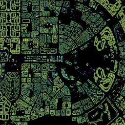
Open Buildings Temporal V1
Open Buildings 2.5D 時系列データセットには、2016 ~ 2023 年に年単位で収集された、建物の存在、建物の小数カウント、建物の高さに関するデータが、有効な空間解像度 4 m(ラスターは 0.5 m 解像度で提供)で含まれています。オープンソースの低解像度画像から生成されます。 アフリカ 年間 アジア 建てられた 高さ オープンビルディング -
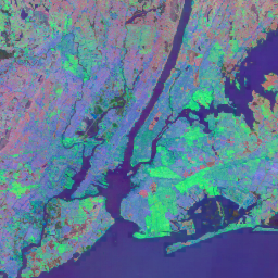
Satellite Embedding V1
Google 衛星エンベディング データセットは、学習済みの地理空間エンベディングのグローバルなコレクションであり、分析にすぐに使用できます。このデータセットの各 10 メートル ピクセルは、64 次元の表現(エンベディング ベクトル)であり、さまざまな地球観測によって測定された、そのピクセルおよびその周辺の表面状態の時間的軌跡をエンコードします。 年次 全世界 Google Landsat 由来 衛星画像 Sentinel-1 由来 -
VIIRS 夜間/昼夜の年間バンド合成 V2.1
年間のグローバル VIIRS 夜間照明データセットは、2013 ~ 2021 年にわたる月ごとの雲のない平均放射強度グリッドから生成された時系列です。2022 年のデータは、NOAA/VIIRS/DNB/ANNUAL_V22 データセットで入手できます。最初のフィルタ処理ステップで、日光、月光、曇りのピクセルが削除され、粗い合成画像が作成されました。 年次 dnb eog ライト 夜間 noaa -
VIIRS 夜間/昼夜の年間バンド合成画像 V2.2
年間のグローバル VIIRS 夜間照明データセットは、2022 年の月ごとの雲のない平均放射グリッドから生成された時系列です。過去のデータは、NOAA/VIIRS/DNB/ANNUAL_V21 データセットで入手できます。最初のフィルタリング ステップで、日光、月光、曇りのピクセルが削除され、次のような粗い合成画像が作成されました。 年次 dnb eog ライト 夜間 noaa
Datasets tagged annual in Earth Engine
[null,null,[],[[["\u003cp\u003eThe Open Buildings Temporal V1 dataset provides annual data (2016-2023) on building presence, counts, and heights across Africa and Asia.\u003c/p\u003e\n"],["\u003cp\u003eThe JRC Yearly Water Classification History, v1.4 dataset offers annual maps and statistics on global surface water distribution and change from 1984 to 2021.\u003c/p\u003e\n"],["\u003cp\u003eThe Global Mangrove Forests Distribution, v1 (2000) dataset presents a global mangrove forest distribution map derived from Landsat satellite data from the year 2000.\u003c/p\u003e\n"],["\u003cp\u003eThe MOD44B.006 Terra Vegetation Continuous Fields Yearly Global 250m dataset provides yearly global vegetation cover estimates, including tree cover percentages.\u003c/p\u003e\n"],["\u003cp\u003eThe VIIRS Nighttime Day/Night Annual Band Composites V2.1 and V2.2 datasets offer annual global nighttime lights data, with V2.1 spanning 2013 to 2021 and V2.2 covering 2022.\u003c/p\u003e\n"]]],["The datasets provide annual global information on various Earth features. The Open Buildings dataset offers building presence, counts, and heights from 2016-2023. JRC data maps surface water distribution and changes from 1984-2021. Another dataset, based on data from 2000, details mangrove forest distribution. MODIS data provides continuous vegetation cover estimates, including tree cover percentages. Lastly, VIIRS data sets map annual nighttime light composites from 2013-2022, based on cloud-free average radiance grids.\n"],null,["# Datasets tagged annual in Earth Engine\n\n-\n\n |-------------------------------------------------------------------------------------------------------------------------------------------------------------------------------------------------------------------------------------------------------------------------------------------------------------------------------|\n | [### Global Mangrove Forests Distribution, v1 (2000)](/earth-engine/datasets/catalog/LANDSAT_MANGROVE_FORESTS) |\n | The database was prepared using Landsat satellite data from the year 2000. More than 1,000 Landsat scenes obtained from the USGS Earth Resources Observation and Science Center (EROS) were classified using hybrid supervised and unsupervised digital image classification techniques. This database is the first, most ... |\n | [annual](/earth-engine/datasets/tags/annual) [ciesin](/earth-engine/datasets/tags/ciesin) [forest-biomass](/earth-engine/datasets/tags/forest-biomass) [global](/earth-engine/datasets/tags/global) [landsat-derived](/earth-engine/datasets/tags/landsat-derived) [mangrove](/earth-engine/datasets/tags/mangrove) |\n\n-\n\n |--------------------------------------------------------------------------------------------------------------------------------------------------------------------------------------------------------------------------------------------------------------------------------------------------------|\n | [### JRC Yearly Water Classification History, v1.4](/earth-engine/datasets/catalog/JRC_GSW1_4_YearlyHistory) |\n | This dataset contains maps of the location and temporal distribution of surface water from 1984 to 2021 and provides statistics on the extent and change of those water surfaces. For more information see the associated journal article: High-resolution mapping of global surface water and its ... |\n | [annual](/earth-engine/datasets/tags/annual) [geophysical](/earth-engine/datasets/tags/geophysical) [google](/earth-engine/datasets/tags/google) [history](/earth-engine/datasets/tags/history) [jrc](/earth-engine/datasets/tags/jrc) [landsat-derived](/earth-engine/datasets/tags/landsat-derived) |\n\n-\n\n |------------------------------------------------------------------------------------------------------------------------------------------------------------------------------------------------------------------------------------------------------------------------------------------------------------------------------------------------------|\n | [### MOD44B.061 Terra Vegetation Continuous Fields Yearly Global 250m](/earth-engine/datasets/catalog/MODIS_061_MOD44B) |\n | The Terra MODIS Vegetation Continuous Fields (VCF) product is a sub-pixel-level representation of surface vegetation cover estimates globally. Designed to continuously represent Earth's terrestrial surface as a proportion of basic vegetation traits, it provides a gradation of three surface cover components: percent tree cover, percent ... |\n | [annual](/earth-engine/datasets/tags/annual) [geophysical](/earth-engine/datasets/tags/geophysical) [global](/earth-engine/datasets/tags/global) [landuse-landcover](/earth-engine/datasets/tags/landuse-landcover) [modis](/earth-engine/datasets/tags/modis) [nasa](/earth-engine/datasets/tags/nasa) |\n\n-\n\n |--------------------------------------------------------------------------------------------------------------------------------------------------------------------------------------------------------------------------------------------------------------------------------------------------------------------------------|\n | [### Open Buildings Temporal V1](/earth-engine/datasets/catalog/GOOGLE_Research_open-buildings-temporal_v1) |\n | The Open Buildings 2.5D Temporal Dataset contains data about building presence, fractional building counts, and building heights at an effective1 spatial resolution of 4m (rasters are provided at 0.5m resolution) at an annual cadence from 2016-2023. It is produced from open-source, low-resolution imagery from the ... |\n | [africa](/earth-engine/datasets/tags/africa) [annual](/earth-engine/datasets/tags/annual) [asia](/earth-engine/datasets/tags/asia) [built-up](/earth-engine/datasets/tags/built-up) [height](/earth-engine/datasets/tags/height) [open-buildings](/earth-engine/datasets/tags/open-buildings) |\n\n-\n\n |-----------------------------------------------------------------------------------------------------------------------------------------------------------------------------------------------------------------------------------------------------------------------------------------------------------------------------------------------|\n | [### Satellite Embedding V1](/earth-engine/datasets/catalog/GOOGLE_SATELLITE_EMBEDDING_V1_ANNUAL) |\n | The Google Satellite Embedding dataset is a global, analysis-ready collection of learned geospatial embeddings. Each 10-meter pixel in this dataset is a 64-dimensional representation, or \"embedding vector,\" that encodes temporal trajectories of surface conditions at and around that pixel as measured by various Earth observation ... |\n | [annual](/earth-engine/datasets/tags/annual) [global](/earth-engine/datasets/tags/global) [google](/earth-engine/datasets/tags/google) [landsat-derived](/earth-engine/datasets/tags/landsat-derived) [satellite-imagery](/earth-engine/datasets/tags/satellite-imagery) [sentinel1-derived](/earth-engine/datasets/tags/sentinel1-derived) |\n\n-\n\n |------------------------------------------------------------------------------------------------------------------------------------------------------------------------------------------------------------------------------------------------------------------------------------------------------------------------------|\n | [### VIIRS Nighttime Day/Night Annual Band Composites V2.1](/earth-engine/datasets/catalog/NOAA_VIIRS_DNB_ANNUAL_V21) |\n | Annual global VIIRS nighttime lights dataset is a time series produced from monthly cloud-free average radiance grids spanning 2013 to 2021. Data for 2022 are available in the NOAA/VIIRS/DNB/ANNUAL_V22 dataset. An initial filtering step removed sunlit, moonlit and cloudy pixels, leading to rough composites that ... |\n | [annual](/earth-engine/datasets/tags/annual) [dnb](/earth-engine/datasets/tags/dnb) [eog](/earth-engine/datasets/tags/eog) [lights](/earth-engine/datasets/tags/lights) [nighttime](/earth-engine/datasets/tags/nighttime) [noaa](/earth-engine/datasets/tags/noaa) |\n\n-\n\n |-----------------------------------------------------------------------------------------------------------------------------------------------------------------------------------------------------------------------------------------------------------------------------------------------------------------------------------|\n | [### VIIRS Nighttime Day/Night Annual Band Composites V2.2](/earth-engine/datasets/catalog/NOAA_VIIRS_DNB_ANNUAL_V22) |\n | Annual global VIIRS nighttime lights dataset is a time series produced from monthly cloud-free average radiance grids for 2022. Data for earlier years are available in the NOAA/VIIRS/DNB/ANNUAL_V21 dataset. An initial filtering step removed sunlit, moonlit and cloudy pixels, leading to rough composites that contains ... |\n | [annual](/earth-engine/datasets/tags/annual) [dnb](/earth-engine/datasets/tags/dnb) [eog](/earth-engine/datasets/tags/eog) [lights](/earth-engine/datasets/tags/lights) [nighttime](/earth-engine/datasets/tags/nighttime) [noaa](/earth-engine/datasets/tags/noaa) |"]]