-
FLDAS: Famine Early Warning Systems Network(FEWS NET)Land Data Assimilation System
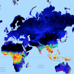
FLDAS データセット(McNally et al. 2017)は、データが少ない発展途上国での食料安全保障の評価を支援するために設計されました。水分量、湿度、蒸発散量、平均土壌温度、総降水量など、気候に関連する多くの変数に関する情報が含まれています。FLDAS データセットは複数あります。 気候 雪氷圏 蒸発散 湿度 ldas 月次 -
GLDAS-2.1: Global Land Data Assimilation System

NASA Global Land Data Assimilation System Version 2(GLDAS-2)には、GLDAS-2.0、GLDAS-2.1、GLDAS-2.2 の 3 つのコンポーネントがあります。GLDAS-2.0 は、Princeton の気象強制入力データのみで強制され、1948 年から 2014 年までの時間的に一貫したシリーズを提供します。GLDAS-2.1 は、モデルの組み合わせで強制されます。 3 時間ごと 気候 雪氷圏 蒸発 強制力 地球物理学 -
GLDAS-2.2: Global Land Data Assimilation System

NASA Global Land Data Assimilation System Version 2(GLDAS-2)には、GLDAS-2.0、GLDAS-2.1、GLDAS-2.2 の 3 つのコンポーネントがあります。GLDAS-2.0 は、Princeton の気象強制入力データのみで強制され、1948 年から 2014 年までの時間的に一貫したシリーズを提供します。GLDAS-2.1 は、モデルの組み合わせで強制されます。 3 時間ごと 気候 雪氷圏 蒸発 強制力 地球物理学 -
NLDAS-2: 北米陸上データ同化システム強制フィールド
陸上データ同化システム(LDAS)は、複数の観測ソース(降雨計データ、衛星データ、レーダー降雨量測定など)を組み合わせて、地球の表面またはその付近の気候特性の推定値を生成します。このデータセットは、フェーズ … のプライマリ(デフォルト)強制ファイル(ファイル A)です。 気候 蒸発 強制力 地球物理学 時間単位 湿度 -
再処理された GLDAS-2.0: Global Land Data Assimilation System
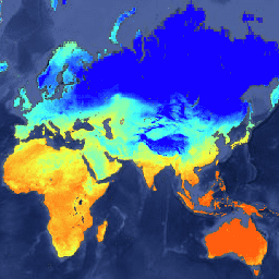
NASA Global Land Data Assimilation System Version 2(GLDAS-2)には、GLDAS-2.0、GLDAS-2.1、GLDAS-2.2 の 3 つのコンポーネントがあります。GLDAS-2.0 は、Princeton の気象強制入力データのみで強制され、1948 年から 2014 年までの時間的に一貫したシリーズを提供します。GLDAS-2.1 は、モデルの組み合わせで強制されます。 3 時間ごと 気候 雪氷圏 蒸発 強制力 地球物理学
Datasets tagged ldas in Earth Engine
[null,null,[],[],[]]