-
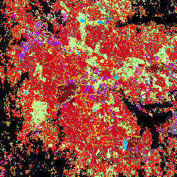
GHSL: 都市化の程度 1975 ~ 2030 V2-0(P2023A)
このラスター データセットは、GHSL プロジェクトによって生成された 1975 ~ 2030 年の 5 年ごとのエポックに関する世界的なグリッド人口と建造物サーフェス データに基づいて、国連統計委員会が推奨する「都市化の程度」ステージ I の手法を用いて、世界規模で複数の期間にわたる農村と都市の分類を表しています。学位 ghsl jrc population sdg settlement -
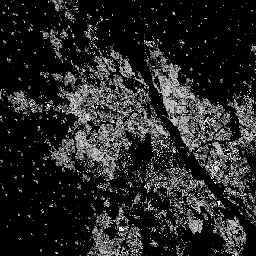
GHSL: グローバル建造物サーフェス 10 m(P2023A)
このラスター データセットは、S2 画像データから観測された 2018 年の建造物サーフェスの分布を、10 m グリッドセルあたりの平方メートルで表しています。データセットでは、a)建造物の総面積と、b)… のグリッドセルに割り当てられた建造物の面積を測定します。 built built-environment builtup copernicus ghsl jrc -
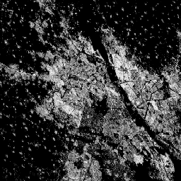
GHSL: 1975 ~ 2030 年の世界の建造物(P2023A)
このラスター データセットは、建造物が建てられている地表の分布を示しています。値は 100 m グリッドセルあたりの平方メートルで表されます。このデータセットでは、a)総建て込み面積と、b)主に非住宅(NRES)用途のグリッドセルに割り当てられた建て込み面積を測定しています。データが空間的および時間的に補間されている built built-environment builtup copernicus ghsl jrc -
GHSL: グローバル決済の特性(10 m)2018(P2023A)
この空間ラスター データセットは、人間の居住地を 10 m の解像度で描画し、建造環境の機能と高さに関連するコンポーネントの観点からその内部特性を記述します。GHSL データ プロダクトの詳細については、GHSL データ パッケージ 2023 レポートをご覧ください。 building built builtup copernicus ghsl height -
World Settlement Footprint 2015
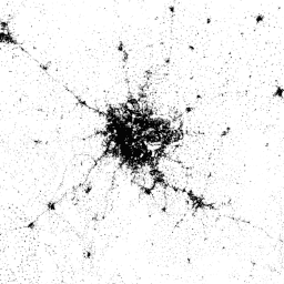
世界居住地フットプリント(WSF)2015 は、2014 ~ 2015 年の Landsat-8 と Sentinel-1 のマルチタイムラベル画像(それぞれ約 217,000 シーンと約 107,000 シーンが処理されています)から導き出された、世界中の人間居住地の範囲を示す 10 m 解像度のバイナリ マスクです。人間の居住地の時間的ダイナミクス landcover landsat-derived population sentinel1-derived settlement urban
Datasets tagged settlement in Earth Engine
[null,null,[],[[["\u003cp\u003eThe World Settlement Footprint 2015 dataset provides a global, 10m resolution binary mask showing the extent of human settlements using 2014-2015 Landsat-8 and Sentinel-1 imagery.\u003c/p\u003e\n"],["\u003cp\u003eThe GHSL datasets offer various perspectives on global built-up areas, including settlement characteristics, built-up surface extent over time, and degree of urbanization.\u003c/p\u003e\n"],["\u003cp\u003eGHSL data is available at different resolutions (10m and 100m) and provides insights into built-up surface area and functional characteristics like building height and residential/non-residential use.\u003c/p\u003e\n"],["\u003cp\u003eThe Degree of Urbanization dataset from GHSL classifies areas globally as rural or urban using a multitemporal approach and gridded population and built-up surface data.\u003c/p\u003e\n"],["\u003cp\u003eThese datasets are derived from various satellite imagery sources including Landsat-8, Sentinel-1, and Sentinel-2 and cover different time periods from 1975 to 2030.\u003c/p\u003e\n"]]],[],null,["# Datasets tagged settlement in Earth Engine\n\n-\n\n |------------------------------------------------------------------------------------------------------------------------------------------------------------------------------------------------------------------------------------------------------------------------------------------------------------------------------------------------|\n | [### GHSL: Degree of Urbanization 1975-2030 V2-0 (P2023A)](/earth-engine/datasets/catalog/JRC_GHSL_P2023A_GHS_SMOD_V2-0) |\n | This raster dataset represents a global, multitemporal rural-urban classification, applying the \"Degree of Urbanisation\" stage I methodology recommended by UN Statistical Commission, based on global gridded population and built-up surface data generated by the GHSL project for the epochs 1975-2030 in 5-year intervals. The Degree ... |\n | [ghsl](/earth-engine/datasets/tags/ghsl) [jrc](/earth-engine/datasets/tags/jrc) [population](/earth-engine/datasets/tags/population) [sdg](/earth-engine/datasets/tags/sdg) [settlement](/earth-engine/datasets/tags/settlement) |\n\n-\n\n |---------------------------------------------------------------------------------------------------------------------------------------------------------------------------------------------------------------------------------------------------------------------------------------------------|\n | [### GHSL: Global built-up surface 10m (P2023A)](/earth-engine/datasets/catalog/JRC_GHSL_P2023A_GHS_BUILT_S_10m) |\n | This raster dataset depicts the distribution of built-up surfaces, expressed in square metres per 10 m grid cell, for 2018 as observed from the S2 image data. The datasets measure: a) the total built-up surface, and b) the built-up surface allocated to grid cells of ... |\n | [built](/earth-engine/datasets/tags/built) [built-environment](/earth-engine/datasets/tags/built-environment) [builtup](/earth-engine/datasets/tags/builtup) [copernicus](/earth-engine/datasets/tags/copernicus) [ghsl](/earth-engine/datasets/tags/ghsl) [jrc](/earth-engine/datasets/tags/jrc) |\n\n-\n\n |--------------------------------------------------------------------------------------------------------------------------------------------------------------------------------------------------------------------------------------------------------------------------------------------------------------------------|\n | [### GHSL: Global built-up surface 1975-2030 (P2023A)](/earth-engine/datasets/catalog/JRC_GHSL_P2023A_GHS_BUILT_S) |\n | This raster dataset depicts the distribution of built-up surfaces, expressed in square metres per 100 m grid cell. The dataset measures: a) the total built-up surface, and b) the built-up surface allocated to grid cells of predominant non-residential (NRES) use. Data are spatially-temporally interpolated or ... |\n | [built](/earth-engine/datasets/tags/built) [built-environment](/earth-engine/datasets/tags/built-environment) [builtup](/earth-engine/datasets/tags/builtup) [copernicus](/earth-engine/datasets/tags/copernicus) [ghsl](/earth-engine/datasets/tags/ghsl) [jrc](/earth-engine/datasets/tags/jrc) |\n\n-\n\n |---------------------------------------------------------------------------------------------------------------------------------------------------------------------------------------------------------------------------------------------------------------------------------------------------------------|\n | [### GHSL: Global settlement characteristics (10 m) 2018 (P2023A)](/earth-engine/datasets/catalog/JRC_GHSL_P2023A_GHS_BUILT_C) |\n | This spatial raster dataset delineates human settlements at 10 m resolution, and describes their inner characteristics in terms of the functional and height-related components of the built environment. More information about the GHSL data products can be found in the GHSL Data Package 2023 report ... |\n | [building](/earth-engine/datasets/tags/building) [built](/earth-engine/datasets/tags/built) [builtup](/earth-engine/datasets/tags/builtup) [copernicus](/earth-engine/datasets/tags/copernicus) [ghsl](/earth-engine/datasets/tags/ghsl) [height](/earth-engine/datasets/tags/height) |\n\n-\n\n |-------------------------------------------------------------------------------------------------------------------------------------------------------------------------------------------------------------------------------------------------------------------------------------------------------------------------------------------|\n | [### World Settlement Footprint 2015](/earth-engine/datasets/catalog/DLR_WSF_WSF2015_v1) |\n | The World Settlement Footprint (WSF) 2015 is a 10m resolution binary mask outlining the extent of human settlements globally derived by means of 2014-2015 multitemporal Landsat-8 and Sentinel-1 imagery (of which \\~217,000 and \\~107,000 scenes have been processed, respectively). The temporal dynamics of human settlements ... |\n | [landcover](/earth-engine/datasets/tags/landcover) [landsat-derived](/earth-engine/datasets/tags/landsat-derived) [population](/earth-engine/datasets/tags/population) [sentinel1-derived](/earth-engine/datasets/tags/sentinel1-derived) [settlement](/earth-engine/datasets/tags/settlement) [urban](/earth-engine/datasets/tags/urban) |"]]