-
MTBS 焼損面積の境界線
Monitoring Trends in Burn Severity(MTBS)の焼失面積境界データセットには、米国本土、アラスカ、ハワイ、プエルトリコで現在完了しているすべての MTBS 火災の焼失面積のポリゴンが含まれています。NBR は「Normalized Burn Ratio(正規化された焼失率)」の略で、dNBR は … eros fire gtac mtbs table usda -
Monitoring Trends in Burn Severity(MTBS)の火傷の重症度画像
火傷の重症度モザイクは、米国本土、アラスカ、ハワイ、プエルトリコで現在完了しているすべての MTBS 火災の MTBS 火傷の重症度クラスのテーマ別ラスター画像で構成されています。モザイク状の火傷の重症度画像は、米国各州と… eros fire forest gtac landcover landsat-derived -
USFS 景観変化監視システム v2024.10(CONUS および OCONUS)
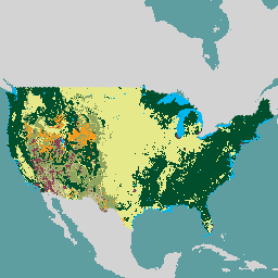
このプロダクトは、景観変化監視システム(LCMS)データスイートの一部です。各年の LCMS モデルの変更、土地被覆、土地利用クラスを示し、米国本土(CONUS)と、アラスカ(AK)、プエルトリコなど、CONUS 外の地域(OCONUS)を対象としています。 change-detection forest gtac landcover landuse landuse-landcover -
USFS Tree Canopy Cover v2023-5(CONUS と OCONUS)
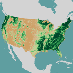
このプロダクトは、樹冠被覆率(TCC)データスイートの一部です。これには、各年のモデル化された TCC、標準誤差(SE)、National Land Cover Database(NLCD)の TCC データが含まれます。米国農務省林野部(USFS)が作成した TCC データは… forest gtac landuse-landcover redcastle-resources usda usfs -
USFS TreeMap v2016(米国本土)
このプロダクトは、TreeMap データ スイートの一部です。このデータセットは、2016 年に米国本土の森林全体にわたる、生きた樹木と枯れた樹木の数、バイオマス、炭素などの森林特性に関する詳細な空間情報を提供します。TreeMap v2016 には 1 つの画像が含まれています。 バイオマス 炭素 気候変動 コンサス 森林 森林バイオマス -
USFS TreeMap v2020
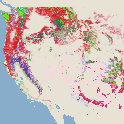
このプロダクトは、TreeMap データ スイートの一部です。このデータセットは、2020 年の米国全土の森林の範囲における、生きた樹木と枯れた樹木の数、バイオマス、炭素などの森林の特性に関する詳細な空間情報を提供します。TreeMap v2020 には 22 バンドの 30 x 30 m の … aboveground biomass carbon climate-change conus forest -
USFS TreeMap v2022
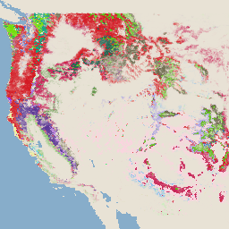
このプロダクトは、TreeMap データ スイートの一部です。2022 年の米国全土の森林の範囲にわたって、生きた木と枯れた木の数、バイオマス、炭素など、森林の特性に関する詳細な空間情報を提供します。TreeMap v2022 には、22 バンドの 30 x 30 m の … aboveground biomass carbon climate-change conus forest
Datasets tagged usfs in Earth Engine
[null,null,[],[[["\u003cp\u003eThe USFS Landscape Change Monitoring System (LCMS) tracks land cover and use changes across the Conterminous US (CONUS) and other areas like Southeastern Alaska and Puerto Rico.\u003c/p\u003e\n"],["\u003cp\u003eMonitoring Trends in Burn Severity (MTBS) provides annual burn severity mosaics and boundaries for fires across the US, including Alaska, Hawaii, and Puerto Rico.\u003c/p\u003e\n"],["\u003cp\u003eThe USFS TreeMap dataset offers detailed forest characteristic information for the continental US, encompassing tree counts, biomass, and carbon estimates for 2016.\u003c/p\u003e\n"],["\u003cp\u003eThe USFS Tree Canopy Cover dataset provides modeled tree canopy cover, standard error, and NLCD tree canopy cover data for CONUS and OCONUS regions.\u003c/p\u003e\n"]]],[],null,["# Datasets tagged usfs in Earth Engine\n\n-\n\n |-------------------------------------------------------------------------------------------------------------------------------------------------------------------------------------------------------------------------------------------------------------------------------------------------------------|\n | [### MTBS Burned Area Boundaries](/earth-engine/datasets/catalog/USFS_GTAC_MTBS_burned_area_boundaries_v1) |\n | The Monitoring Trends in Burn Severity (MTBS) burned area boundaries dataset contains the extent polygons of the burned areas of all currently completed MTBS fires for the continental United States, Alaska, Hawaii, and Puerto Rico. Below NBR stands for \"Normalized Burn Ratio\", while dNBR stands ... |\n | [eros](/earth-engine/datasets/tags/eros) [fire](/earth-engine/datasets/tags/fire) [gtac](/earth-engine/datasets/tags/gtac) [mtbs](/earth-engine/datasets/tags/mtbs) [table](/earth-engine/datasets/tags/table) [usda](/earth-engine/datasets/tags/usda) |\n\n-\n\n |------------------------------------------------------------------------------------------------------------------------------------------------------------------------------------------------------------------------------------------------------------------------------------------------|\n | [### Monitoring Trends in Burn Severity (MTBS) Burn Severity Images](/earth-engine/datasets/catalog/USFS_GTAC_MTBS_annual_burn_severity_mosaics_v1) |\n | The burn severity mosaics consist of thematic raster images of MTBS burn severity classes for all currently completed MTBS fires for the continental United States, Alaska, Hawaii and Puerto Rico. Mosaicked burn severity images are compiled annually for each year by US State and the ... |\n | [eros](/earth-engine/datasets/tags/eros) [fire](/earth-engine/datasets/tags/fire) [forest](/earth-engine/datasets/tags/forest) [gtac](/earth-engine/datasets/tags/gtac) [landcover](/earth-engine/datasets/tags/landcover) [landsat-derived](/earth-engine/datasets/tags/landsat-derived) |\n\n-\n\n |-----------------------------------------------------------------------------------------------------------------------------------------------------------------------------------------------------------------------------------------------------------------------------------------------------------------------------|\n | [### USFS Landscape Change Monitoring System v2024.10 (CONUS and OCONUS)](/earth-engine/datasets/catalog/USFS_GTAC_LCMS_v2024-10) |\n | This product is part of the Landscape Change Monitoring System (LCMS) data suite. It shows LCMS-modeled change, land cover, and/or land use classes for each year and covers the Conterminous United States (CONUS) as well as areas outside the CONUS (OCONUS) including Alaska (AK), Puerto ... |\n | [change-detection](/earth-engine/datasets/tags/change-detection) [forest](/earth-engine/datasets/tags/forest) [gtac](/earth-engine/datasets/tags/gtac) [landcover](/earth-engine/datasets/tags/landcover) [landuse](/earth-engine/datasets/tags/landuse) [landuse-landcover](/earth-engine/datasets/tags/landuse-landcover) |\n\n-\n\n |-------------------------------------------------------------------------------------------------------------------------------------------------------------------------------------------------------------------------------------------------------------------------------------------------------------------|\n | [### USFS Tree Canopy Cover v2023-5 (CONUS and OCONUS)](/earth-engine/datasets/catalog/USGS_NLCD_RELEASES_2023_REL_TCC_v2023-5) |\n | This product is part of the Tree Canopy Cover (TCC) data suite. It includes modeled TCC, standard error (SE), and National Land Cover Database's (NLCD) TCC data for each year. TCC data produced by the the United States Department of Agriculture, Forest Service (USFS) are ... |\n | [forest](/earth-engine/datasets/tags/forest) [gtac](/earth-engine/datasets/tags/gtac) [landuse-landcover](/earth-engine/datasets/tags/landuse-landcover) [redcastle-resources](/earth-engine/datasets/tags/redcastle-resources) [usda](/earth-engine/datasets/tags/usda) [usfs](/earth-engine/datasets/tags/usfs) |\n\n-\n\n |---------------------------------------------------------------------------------------------------------------------------------------------------------------------------------------------------------------------------------------------------------------------------------------------------------------|\n | [### USFS TreeMap v2016 (Conterminous United States)](/earth-engine/datasets/catalog/USFS_GTAC_TreeMap_v2016) |\n | This product is part of the TreeMap data suite. It provides detailed spatial information on forest characteristics including number of live and dead trees, biomass, and carbon across the entire forested extent of the continental United States in 2016. TreeMap v2016 contains one image, a ... |\n | [biomass](/earth-engine/datasets/tags/biomass) [carbon](/earth-engine/datasets/tags/carbon) [climate-change](/earth-engine/datasets/tags/climate-change) [conus](/earth-engine/datasets/tags/conus) [forest](/earth-engine/datasets/tags/forest) [forest-biomass](/earth-engine/datasets/tags/forest-biomass) |\n\n-\n\n |---------------------------------------------------------------------------------------------------------------------------------------------------------------------------------------------------------------------------------------------------------------------------------------------------------|\n | [### USFS TreeMap v2020](/earth-engine/datasets/catalog/USFS_GTAC_TreeMap_v2020) |\n | This product is part of the TreeMap data suite. It provides detailed spatial information on forest characteristics including number of live and dead trees, biomass, and carbon across the entire forested extent of the United States in 2020. TreeMap v2020 contains 22-band 30 x 30m ... |\n | [aboveground](/earth-engine/datasets/tags/aboveground) [biomass](/earth-engine/datasets/tags/biomass) [carbon](/earth-engine/datasets/tags/carbon) [climate-change](/earth-engine/datasets/tags/climate-change) [conus](/earth-engine/datasets/tags/conus) [forest](/earth-engine/datasets/tags/forest) |\n\n-\n\n |---------------------------------------------------------------------------------------------------------------------------------------------------------------------------------------------------------------------------------------------------------------------------------------------------------|\n | [### USFS TreeMap v2022](/earth-engine/datasets/catalog/USFS_GTAC_TreeMap_v2022) |\n | This product is part of the TreeMap data suite. It provides detailed spatial information on forest characteristics including number of live and dead trees, biomass, and carbon across the entire forested extent of the United States in 2022. TreeMap v2022 contains 22-band 30 x 30m ... |\n | [aboveground](/earth-engine/datasets/tags/aboveground) [biomass](/earth-engine/datasets/tags/biomass) [carbon](/earth-engine/datasets/tags/carbon) [climate-change](/earth-engine/datasets/tags/climate-change) [conus](/earth-engine/datasets/tags/conus) [forest](/earth-engine/datasets/tags/forest) |"]]