Page Summary
-
The GRIDMET DROUGHT dataset provides drought indices like SPI, EDDI, SPEI, and PDSI derived from the 4-km daily GRIDMET dataset for the contiguous United States.
-
The GRIDMET dataset from the University of Idaho offers high spatial resolution (~4-km) daily surface meteorological data including temperature, precipitation, winds, humidity, and radiation across the contiguous United States since 1979.
-
GRIDMET DROUGHT: CONUS Drought Indices
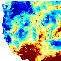
This dataset contains drought indices derived from the 4-km daily Gridded Surface Meteorological (GRIDMET) dataset. The drought indices provided include the standardized precipitation index (SPI), the evaporative drought demand index (EDDI), the standardized precipitation evapotranspiration index (SPEI), the Palmer Drought Severity Index (PDSI) and Palmer … climate conus crop drought evapotranspiration geophysical -
GRIDMET: University of Idaho Gridded Surface Meteorological Dataset
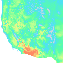
The Gridded Surface Meteorological dataset provides high spatial resolution (~4-km) daily surface fields of temperature, precipitation, winds, humidity and radiation across the contiguous United States from 1979. The dataset blends the high resolution spatial data from PRISM with the high temporal resolution data from the … climate gridmet humidity merced metdata precipitation