Page Summary
-
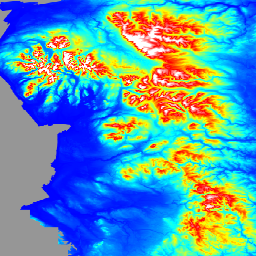
Multiple AHN datasets provide detailed elevation data for the Netherlands with varying versions and samples included or removed.
-
Australian 5M DEM offers a bare earth model derived from numerous LiDAR surveys across over 245,000 square kilometers.
-
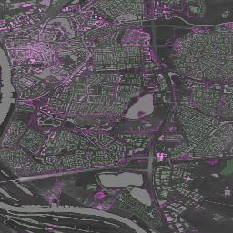
The England 1m Composite DTM/DSM from the Environment Agency provides both Digital Terrain and Digital Surface Models at 1m resolution for nearly all of England.
-
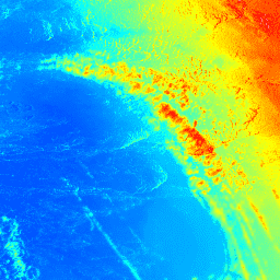
Gridded GEDI datasets offer near-global vegetation structure metrics and biomass density at multiple resolutions derived from satellite lidar footprints.
-
NEON datasets include a Canopy Height Model and Digital Elevation Models (DSM and DTM) derived from airborne LiDAR data.
-
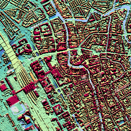
AHN Netherlands 0.5m DEM, Interpolated
The AHN DEM is a 0.5m DEM covering the Netherlands. It was generated from LIDAR data taken in the spring between 2007 and 2012. It contains ground level samples with all other items above ground (such as buildings, bridges, trees etc.) removed. This version is … ahn dem elevation elevation-topography geophysical lidar -
AHN Netherlands 0.5m DEM, Non-Interpolated
The AHN DEM is a 0.5m DEM covering the Netherlands. It was generated from LIDAR data taken in the spring between 2007 and 2012. It contains ground level samples with all other items above ground (such as buildings, bridges, trees etc.) removed. This version is … ahn dem elevation elevation-topography geophysical lidar -
AHN Netherlands 0.5m DEM, Raw Samples
The AHN DEM is a 0.5m DEM covering the Netherlands. It was generated from LIDAR data taken in the spring between 2007 and 2012. This version contains both ground level samples and items above ground level (such as buildings, bridges, trees etc). The point cloud … ahn dem elevation elevation-topography geophysical lidar -
AHN3: Netherlands AHN 0.5m
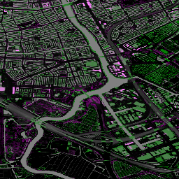
The Actueel Hoogtebestand Nederland (AHN) is a dataset with detailed and precise elevation data for the whole of the Netherlands. Elevation information was collected from helicopters and aircraft using laser technology with vertical accuracy of 5 cm. AHN3 Dataset contains the Netherlands AHN 0.5m DSM … ahn dem elevation elevation-topography geophysical lidar -
AHN4: Netherlands AHN 0.5m
The Actueel Hoogtebestand Nederland (AHN) is a dataset with detailed and precise elevation data for the whole of the Netherlands. Elevation information was collected from helicopters and aircraft using laser technology with vertical accuracy of 5 cm. AHN4 Dataset contains the Netherlands AHN 0.5m DSM … ahn dem elevation elevation-topography geophysical lidar -
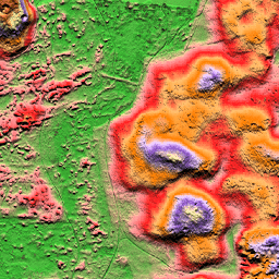
Australian 5M DEM
The Digital Elevation Model (DEM) 5 meter Grid of Australia derived from LiDAR model represents a National 5 meter (bare earth) DEM which has been derived from some 236 individual LiDAR surveys between 2001 and 2015 covering an area in excess of 245,000 square kilometers. … australia dem elevation elevation-topography ga geophysical -
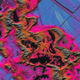
England 1m Composite DTM/DSM (Environment Agency)
The LIDAR Composite DTM/DSM is a raster terrain model covering ~99% of England at 1m spatial resolution, produced by the UK Environment Agency in 2022. The model contains 3 bands of terrain data: a Digital Terrain Model (DTM), a first return Digital Surface Model (DSM), … dem elevation elevation-topography lidar -
Gridded GEDI Vegetation Structure Metrics and Biomass Density with COUNTS metrics, 12KM pixel size
This dataset consists of near-global, analysis-ready, multi-resolution gridded vegetation structure metrics derived from NASA Global Ecosystem Dynamics Investigation (GEDI) Level 2 and 4A products associated with 25-m diameter lidar footprints. This dataset provides a comprehensive representation of near-global vegetation structure that is inclusive of the … biomass canopy forest forest-biomass gedi larse -
Gridded GEDI Vegetation Structure Metrics and Biomass Density with COUNTS metrics, 1KM pixel size
This dataset consists of near-global, analysis-ready, multi-resolution gridded vegetation structure metrics derived from NASA Global Ecosystem Dynamics Investigation (GEDI) Level 2 and 4A products associated with 25-m diameter lidar footprints. This dataset provides a comprehensive representation of near-global vegetation structure that is inclusive of the … biomass canopy forest forest-biomass gedi larse -
Gridded GEDI Vegetation Structure Metrics and Biomass Density with COUNTS metrics, 6KM pixel size
This dataset consists of near-global, analysis-ready, multi-resolution gridded vegetation structure metrics derived from NASA Global Ecosystem Dynamics Investigation (GEDI) Level 2 and 4A products associated with 25-m diameter lidar footprints. This dataset provides a comprehensive representation of near-global vegetation structure that is inclusive of the … biomass canopy forest forest-biomass gedi larse -
Gridded GEDI Vegetation Structure Metrics and Biomass Density, 12KM pixel size
This dataset consists of near-global, analysis-ready, multi-resolution gridded vegetation structure metrics derived from NASA Global Ecosystem Dynamics Investigation (GEDI) Level 2 and 4A products associated with 25-m diameter lidar footprints. This dataset provides a comprehensive representation of near-global vegetation structure that is inclusive of the … biomass canopy forest forest-biomass gedi larse -
Gridded GEDI Vegetation Structure Metrics and Biomass Density, 1KM pixel size
This dataset consists of near-global, analysis-ready, multi-resolution gridded vegetation structure metrics derived from NASA Global Ecosystem Dynamics Investigation (GEDI) Level 2 and 4A products associated with 25-m diameter lidar footprints. This dataset provides a comprehensive representation of near-global vegetation structure that is inclusive of the … biomass canopy forest forest-biomass gedi larse -
Gridded GEDI Vegetation Structure Metrics and Biomass Density, 6KM pixel size
This dataset consists of near-global, analysis-ready, multi-resolution gridded vegetation structure metrics derived from NASA Global Ecosystem Dynamics Investigation (GEDI) Level 2 and 4A products associated with 25-m diameter lidar footprints. This dataset provides a comprehensive representation of near-global vegetation structure that is inclusive of the … biomass canopy forest forest-biomass gedi larse -
NEON Canopy Height Model (CHM)
Height of the top of canopy above bare earth (Canopy Height Model; CHM). The CHM is derived from the NEON LiDAR point cloud and is generated by creating a continuous surface of canopy height estimates across the entire spatial domain of the LiDAR survey. The … airborne canopy forest forest-biomass highres lidar -
NEON Digital Elevation Model (DEM)
Digital models of the surface (DSM) and terrain (DTM) derived from NEON LiDAR data. DSM: Surface features (topographic information with vegetation and man-made structures present). DTM: Bare earth elevation (topographic information with vegetation and man-made structures removed). Images are given in meters above mean sea … airborne dem elevation-topography forest highres lidar