-
FAO GAUL 500m Simplified: Global Administrative Unit Layers 2015, Country Boundaries

此版本的 GAUL 数据集已简化为 500 米。全球行政区划层 (GAUL) 汇编并传播有关世界各国行政区划的最佳可用信息,有助于实现表示行政区划的空间数据集的标准化。… 边界 国家/地区 fao gaul infrastructure-boundaries 表格 -
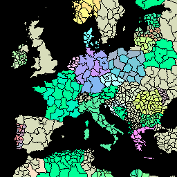
FAO GAUL 500m Simplified: Global Administrative Unit Layers 2015, First-Level Administrative Units

此版本的 GAUL 数据集已简化为 500 米。全球行政区划层 (GAUL) 汇编并传播有关世界各国行政区划的最佳可用信息,有助于实现表示行政区划的空间数据集的标准化。… 边界 部门 fao gaul infrastructure-boundaries 省份 -
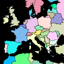
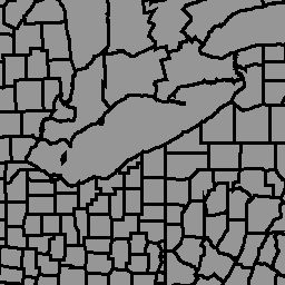
FAO GAUL 500m Simplified:全球行政单位层 2015 年,二级行政单位

此版本的 GAUL 数据集已简化为 500 米。全球行政区划层 (GAUL) 汇编并传播有关世界各国行政区划的最佳可用信息,有助于实现表示行政区划的空间数据集的标准化。… 边界 县 行政区 粮农组织 GAUL 基础设施边界 -
FAO GAUL:全球行政单位图层 2015 年版,国家/地区边界
全球行政区划层 (GAUL) 汇编并传播有关世界各国行政区划的最佳可用信息,有助于实现表示行政区划的空间数据集的标准化。GAUL 始终维护具有统一 … 的全球图层 边界 国家/地区 fao gaul infrastructure-boundaries 表格 -
FAO GAUL:2015 年全球行政区划层级,一级行政区
全球行政区划层 (GAUL) 汇编并传播有关世界各国行政区划的最佳可用信息,有助于实现表示行政区划的空间数据集的标准化。GAUL 始终维护具有统一 … 的全球图层 边界 部门 fao gaul infrastructure-boundaries 省份 -
FAO GAUL:全球行政区划层级 2015 年,二级行政区

全球行政区划层 (GAUL) 汇编并传播有关世界各国行政区划的最佳可用信息,有助于实现表示行政区划的空间数据集的标准化。GAUL 始终维护具有统一 … 的全球图层 边界 县 行政区 粮农组织 GAUL 基础设施边界 -
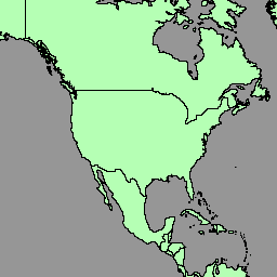
LSIB 2017:大规模国际边界多边形,详细

美国地理学家办公室提供大规模国际边界 (LSIB) 数据集。它源自另外两个数据集:LSIB 线矢量文件和美国国家地理空间情报局 (NGA) 的世界矢量海岸线 (WVS)。内部边界反映了美国政府… 边界 国家/地区 dos 基础设施边界 政治 表格 -
LSIB 2017:简化的大规模国际边界多边形
美国地理学家办公室提供大规模国际边界 (LSIB) 数据集。详细版本 (2013) 派生自另外两个数据集:LSIB 线矢量文件和美国国家地理空间情报局 (NGA) 的世界矢量海岸线 (WVS)。内部边界… 边界 国家/地区 dos 基础设施边界 政治 表格 -
联合国地理空间数据:BNDA_simplified
联合国地理空间数据(简称“地理数据”)是联合国提供的全球地理空间数据集。联合国地理数据旨在帮助联合国准备地图资料,其中包含几何图形、属性和标签,以便充分描绘和命名… 边框 国家/地区 基础设施边界 表格 -
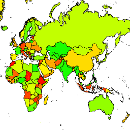
geoBoundaries:国家级 (ADM0) 政治行政边界,v6.0.0

GeoBoundaries 全球政治行政边界数据库是一个在线的开放许可资源,其中包含世界各国/地区的边界(即州、县)。目前,系统会跟踪 199 个实体,包括所有 195 个联合国成员国、格陵兰、台湾、纽埃和科索沃。Comprehensive Global … 边框 国家/地区 基础设施边界 表格 -
geoBoundaries:区级 (ADM1) 政治行政边界,v6.0.0

GeoBoundaries 全球政治行政边界数据库是一个在线的开放许可资源,其中包含世界各国/地区的边界(即州、县)。目前,系统会跟踪 199 个实体,包括所有 195 个联合国成员国、格陵兰、台湾、纽埃和科索沃。Comprehensive Global … 边框 国家/地区 基础设施边界 表格 -
geoBoundaries:市级 (ADM2) 政治行政边界,v6.0.0
GeoBoundaries 全球政治行政边界数据库是一个在线的开放许可资源,其中包含世界各国/地区的边界(即州、县)。目前,系统会跟踪 199 个实体,包括所有 195 个联合国成员国、格陵兰、台湾、纽埃和科索沃。Comprehensive Global … 边框 国家/地区 基础设施边界 表格
Datasets tagged borders in Earth Engine
[null,null,[],[],["The Global Administrative Unit Layers (GAUL) datasets compile administrative units for all countries, standardizing spatial data. These datasets include country boundaries and first and second-level administrative units, with simplified 500m versions. United Nations Geodata offers a worldwide geospatial dataset. The Large Scale International Boundary (LSIB) dataset from the U.S. Office of the Geographer provides detailed and simplified international boundaries. geoBoundaries offers an open-source database of political administrative boundaries at the country, district, and municipality levels.\n"]]